In the Netherlands, a mobile RTK GPS receiver is often used. With such a receiver the exact position can be determined. This is accurate to the centimeter.
A mobile RTK GPS receiver is a measuring device that can determine its position to the nearest centimeter using satellite signals. Such an RTK GPS receiver is often used in land surveying (surveying and plotting), but also in autonomously controlled vehicles, such as agricultural vehicles.
To make everything clear on this topic, we will answer the following questions in this article:
- What is a mobile RTK GPS receiver?
- How does a mobile RTK GPS receiver work?
- How does a rover differ from a GPS in a phone?
- Where is a mobile RTK GPS receiver applied?
- What should you look for when buying a mobile RTK GPS receiver?
Mobile RTK GPS receiver: the solution
You may not have the opportunity to read this entire article. Therefore, there is another opportunity to learn more about Mobile RTK GPS receiver.
You can try a GPS measurement system with such a GPS receiver through this website. To do so, look directly at this page.
You can also request a demonstration of one of our GPS surveying systems. At this demonstration you can then also ask specific questions about Mobile RTK GPS receiver and of course other topics related to GPS surveying.
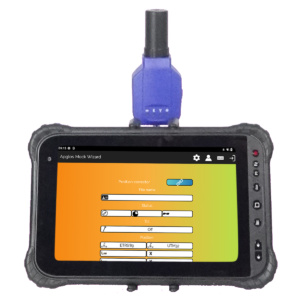
If you don't have time for a demonstration or want to try the software of our GPS measurement systems quickly in between, that is possible. Apglos Survey Wizard is the easiest software to perform GPS measurements with. You can download it for free from the Google Play Store.
The surveying app Apglos Survey Wizard has full functionality with your Android device's GPS. So you can fully test this app and it is free.
Of course, the accuracy of our GPS receivers is better than that of standard Android devices. So if you would like to do a test with an accurate system, check out this page.
What is a mobile RTK GPS receiver?
To answer this question, I will explain the different parts of the definition mobile RTK GPS receiver.
GPSGPS is an abbreviation, which stands for Global Positioning System. So it is a system that allows you to determine your position anywhere in the world.
Receiver: Positioning using GPS is done through satellites, which orbit the earth. The satellites send signals, which GPS uses to determine the position exactly. The satellite signals must get to the GPS. This is done through the receiver, or antenna.
RTK: RTK is an abbreviation, which stands for Real Time Kinematic. This means that the GPS position is determined accurately at the time of reception, even if the receiver of the satellite signals moves.
Mobile: To get an accurate position fix, the position must be corrected. This can be done through its own fixed base station. But in the case of a mobile RTK GPS receiver, a network of base stations is used, where the corrections are sent to the RTK GPS receiver via the Internet.
So a mobile RTK GPS receiver is a device, which receives satellite signals and converts them to an accurate position using correction data, which the receiver receives over the Internet.
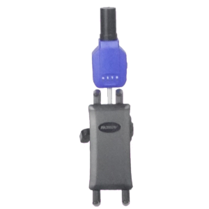
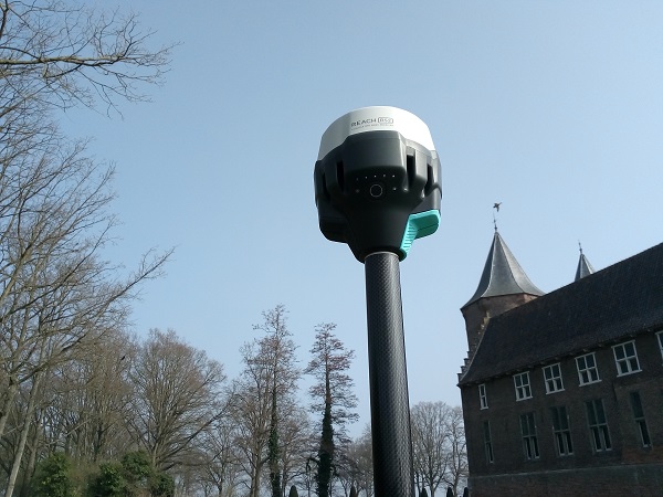
In surveying, such an RTK GPS receiver is also called a rover.
How does a mobile RTK GPS receiver work?
A mobile RTK GPS receiver or rover uses its internal antenna to receive satellite signals from the GPS satellites and other satellites, which transmit position data. These include the European Galileo system, the Russian GLONASS system and the Chinese BEIDOU system.
From these satellite signals, the rover calculates a global position. This global position is expressed in an NMEA line. NMEA stands for National Marine Electronics Association. This line contains the position data.
However, this position still needs to be corrected because the position is not accurate enough. The corrections are determined using a network of GPS receivers scattered throughout the Netherlands.
These GPS receivers are at a fixed known position and receive satellite signals continuously. Because they are at fixed known positions, they can determine the correction of each satellite signal received.
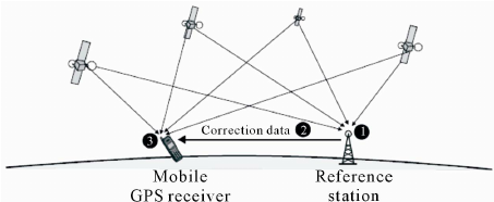
To receive these correction signals from the network of GPS receivers, the rover sends the NMEA line to a particular site of the Internet via NTRIP, Networked Transport or RTCM via Internet Protocol.
This particular website or NTRIP caster, looks at which GPS receiver from the network is closest to the rover and sends those signals via RTCM (The Radio Technical Commission for Maritime Services) to the mobile RTK GPS receiver.
These RTCM messages contain the corrections of the nearest GPS receiver from the GPS receiver network.
The RTK GPS receiver uses these corrections to correct the global position to a centimeter-accurate position.
How does a rover differ from a GPS in a phone?
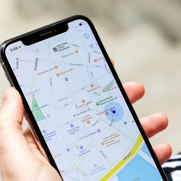
There is also a GPS module in most phones. With this GPS module, you can also determine a position. Still, this position is not as accurate as if you were measuring with a mobile RTK GPS receiver.
Earlier I described how a rover works:
- Receiving satellite data
- Converting satellite data to global position
- Sending global position to Ntrip caster
- Ntrip caster determines the nearest fixed GPS receiver
- NTRIP caster sends the correction signals from this fixed GPS receiver to the rover
- Corrections are used to determine the exact position.
These are six steps to obtain an accurate position.
The GPS module in a phone does not do all the steps. It only performs steps 1 and 2. Because of this, a phone will only give you a global position.
Even if the GPS module of a phone would already do step 3, steps 4 and 5 are also performed, but then the GPS module of a phone cannot perform step 6, because the calculation module to include the corrections in the positioning is not integrated in the GPS module of the phone.
So that's the difference between a GPS in a phone and a mobile RTK GPS receiver.
Where is a mobile RTK GPS receiver applied?
RTK GPS receivers are actually widely used because they are mobile. This includes surveying. With GPS, one can precisely map any object.
But of course, mobile RTK GPS receivers are also used in agriculture, for self-driving vehicles. Partly because of this, agriculture is becoming automated.
In addition, people are currently busy applying RTK GPS receivers in autonomous driving vehicles and vessels.
Another application is on excavators. This allows the excavator operator to dig by coordinates. Which makes it easier to construct the design.
In fact, anything that requires an exact position at any time benefits from a rover.
What should you look for when buying a mobile RTK GPS receiver?
As you may know, there are many mobile RTK GPS receivers. Some examples are:
- Altus NR3
- Spectra SP60
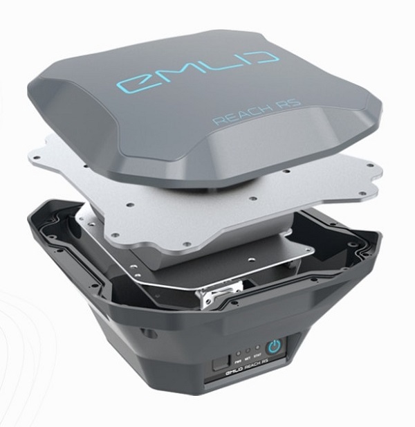
- Emlid Reach RS2
And so there are many others. But if you want to buy one of those RTK GPS receivers, there are a number of things to look out for.
First, pay attention to the amount of different satellite constellations, which the GNSS receiver can receive. There are several satellite constellations, such as GPS, GLONASS, GALILEO and BEIDOU.
In addition, each satellite constellation still has different paths. For example, GPS still has L1, L2 and L5.
The more different satellite constellations and paths a mobile RTK GPS receiver can receive, the better the rover functions in more difficult conditions.
More difficult conditions include locations, where due to trees or buildings, some of the satellite signals are blocked.
A rover must receive enough satellite signals to accurately determine a position.
And when it can use more satellite constellations and paths, when blocked by trees or buildings, there are often still enough satellite signals left to determine an exact position.
Another important thing to look at is the output of the RTK GPS receiver. And this can be divided into two parts.
What communication protocol do you need to process the accurate position for the functionality you need. This could include Bluetooth, Wi-Fi or USB cable.
In addition, it is important to make sure that the controlled position is actually communicated in the correct way. By default, this communication is with NMEA rules. But some functionalities may require other communication output.
Final Conclusion
This was a whole article about Mobile RTK GPS receiver. There is a lot to report on this topic of GPS surveying. So we hope that you have picked up at least a few things from it and can take advantage of them.
However, everything written in this article is theory. If you want to put this theory into practice you can.
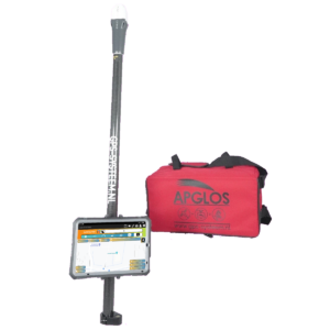
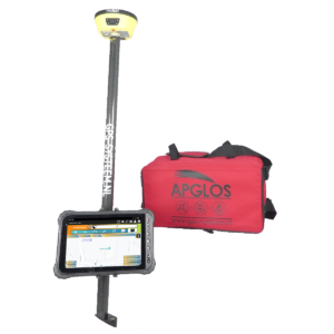
Indeed, you can use this website to purchase a GPS measurement system try or buy. When you do then you can put into practice what you learned by reading this article on Mobile RTK GPS receiver right away. And you can see if working with our GPS measuring equipment is something for you.
Of course, when you try or buy one of our GPS measurement systems, you will receive a short and clear explanation so that you can get started with it right away.
If you would like a demonstration first, you can book one here. With a demonstration or a brief explanation you can also ask specific questions about predators.
 Want to schedule a demo? You can do that through whats!