Description
Get the most out of your tablet with the GIS Expansion package. This expansion kit gives your current tablet new capabilities by adding advanced measurement technologies. With our extensive range of accessories, you can now perform accurate GIS measurements even in the most demanding environments. The GIS Expansion Package opens the door to precision and efficiency, allowing you to take your projects to the next level without the need for new hardware.
Advantages
The GIS Extension package brings many benefits:
- High Accuracy: Centimeter-accurate surveying provides very high precision, which is essential for detailed spatial analysis and mapping.
- More efficient Project Planning: With accurate surveying, projects can be planned and executed more efficiently because planners and designers have detailed and reliable data about the site and its surroundings.
- Enhanced Spatial Visualization: Accurate surveying contributes to improved spatial visualization and presentation of data, which helps effectively communicate results and findings to stakeholders.
- Better Integration with GPS Technology: Centimeter-accurate surveying can be seamlessly integrated with GPS technology, allowing users to collect and analyze real-time location-based data.
Applications
The GIS Extension package is used in such applications as:
- Nature Conservation: GIS systems are used for biodiversity conservation, ecological habitat monitoring and protected area management. This includes identifying vulnerable ecosystems, tracking species and maintaining the natural balance.
- City Management: City infrastructure, including roads, sewers and public facilities, is efficiently maintained using GIS measurements. This includes planning maintenance activities, managing waste collection and improving city services.
- Environmental Monitoring: Air quality, soil pollution and water flows are monitored with accurate GIS measurements. This helps identify environmental problems, evaluate environmental impacts and implement appropriate environmental policies.
- Urban Renewal: GIS measurements play a crucial role in revitalizing city centers, redeveloping neglected areas and reusing vacant land. This includes planning redevelopment projects, improving livability and promoting economic growth.
- Culture and recreation: For managing cultural institutions, recreational facilities and events, GIS measurements are essential. This includes planning cultural events, developing recreational activities and promoting tourism.
- Agricultural Research: For evaluating crop yields, agricultural practices and soil health, GIS measurements are crucial. This includes analyzing soil conditions, planning irrigation systems and predicting crop yields.
Content
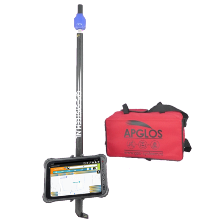
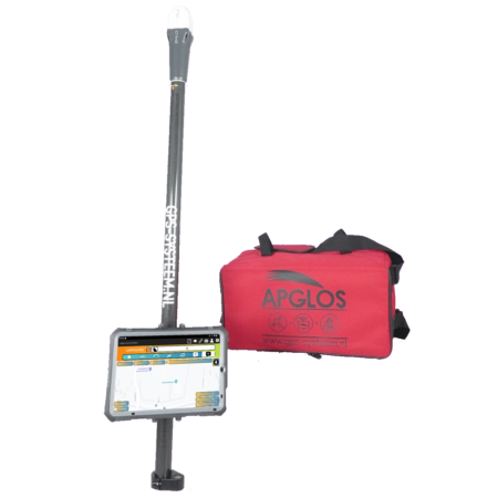
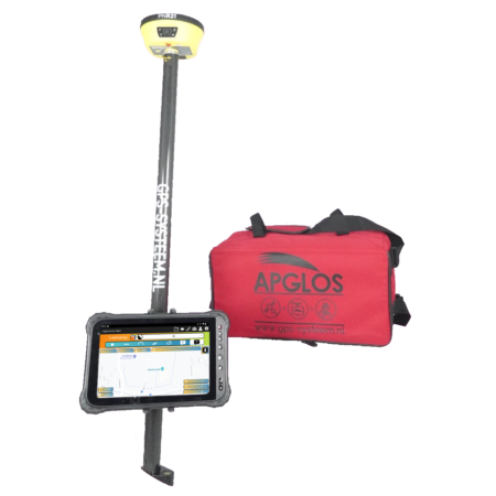
This GIS Extension package consists of:
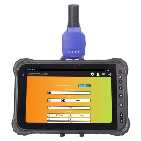
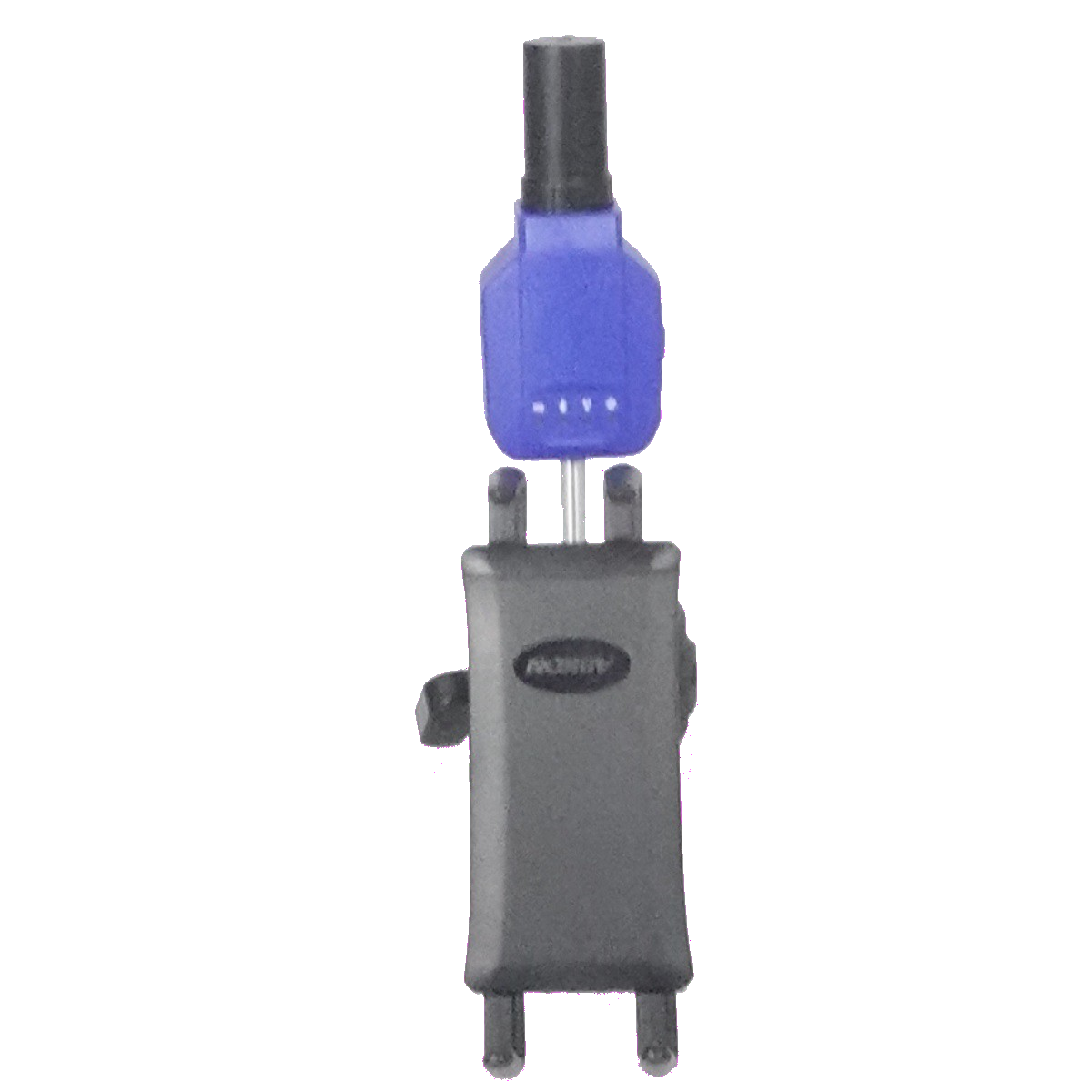
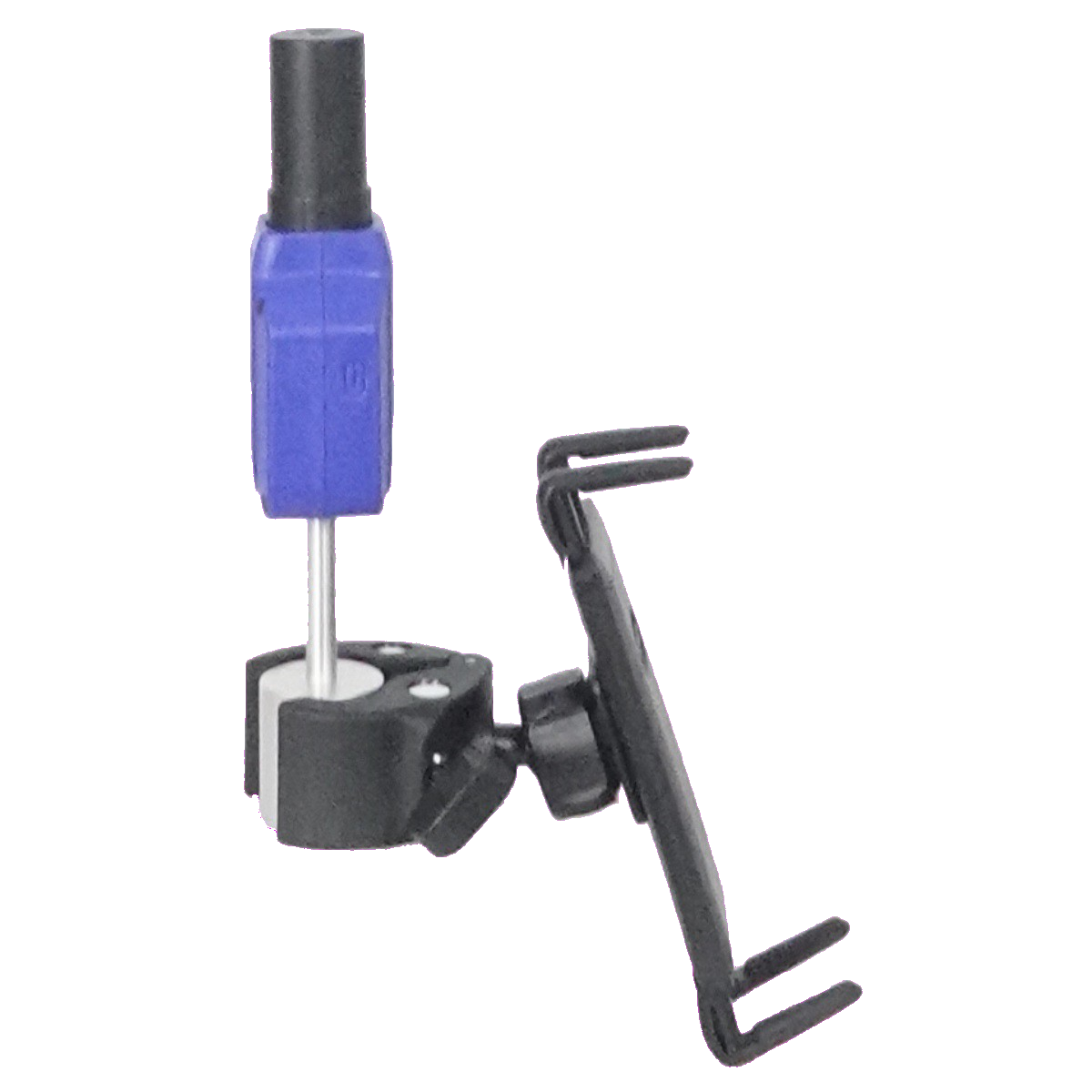
- Toknav P8: Provides advanced GPS functionality for accurate positioning and tracking, allowing you to obtain reliable location data for various GIS applications.
- Apglos Position Corrector subscription package Without SIM: Provides access to regular updates and new features, keeping you always up-to-date with the latest developments in GIS technology, without the need for a SIM card.
- Tablet Holder: Provides a stable and secure attachment of your tablet, allowing you to work hands-free and easily access your GIS applications during fieldwork.
Flexibility and Mobility: By extending your existing device with GIS functionality, you maintain the mobility and flexibility to perform GIS tasks on site. This makes fieldwork, site surveys and data collection more efficient and convenient.