What is GPS? is a common question. The same is true when it comes to surveying and GPS surveying equipment.
So what is GPS? GPS is the total system that uses satellites orbiting the earth to determine position anywhere in the world. The total system consists of GPS satellites and a GPS receiver. The position is determined at the location of the receiver.
To make everything clear on this topic, we will answer the following questions in this article:
- What is GPS?
- What does GPS stand for?
- How does GPS work?
- What is the difference between GPS and GNSS?
- Who manages the GPS system?
- Who invented GPS?
- What applications of GPS are there?
- How to work with GPS.
What is GPS: the solution
You may not have the opportunity to read this entire article. Therefore, there is another opportunity to learn more about What is GPS?.
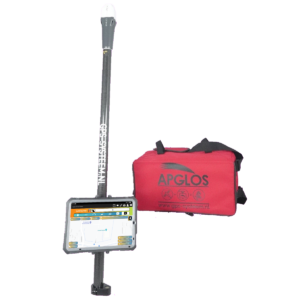
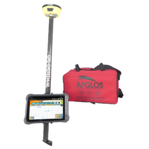
You can try a GPS measurement system through this website. To do so, look directly at this page.
You can also request a demonstration of one of our surveying systems. At this demonstration you can then also ask specific questions about GPS and, of course, other topics related to surveying.
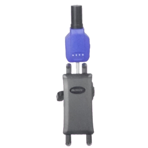
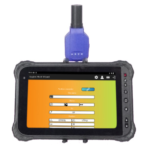
If you don't have time for a demonstration or want to quickly try the software of our measurement systems in between, that is possible. Apglos Survey Wizard is the easiest software to perform GPS measurements with. You can download it for free from the Google Play Store.
The surveying app Apglos Survey Wizard has full functionality with your Android device's GPS. So you can fully test this app and it is free.
Of course, the accuracy of our GPS receivers is better than that of standard Android devices. So if you would like to do a test with an accurate system, check out this page.
What is GPS?
Everyone uses the term GPS quite often. Especially when it comes to finding a location or position. As such, it is a widely used system that has many applications. But I'll write more about the applications later in this article.
Now back to the question What is GPS? GPS is the overall system of using satellites to determine position on the earth.
This concerns not only in the United States. GPS is originally American. No, position can be determined anywhere in the world through these satellites.
And determining that position through this GPS system does not require much. There is hardly anyone left who does not use a device that uses GPS on a daily basis.
In fact, GPS receivers are in almost every cell phone. This has greatly increased the functionality of the cell phone. With a cell phone, the integrated GPS receiver allows much more than just calling, texting and surfing the Internet.
There are many apps created for cell phones that use the GPS receiver in the cell phone. All these apps have the purpose of using the position, which is determined from GPS, in some way.
An example of such an app is Apglos Survey Wizard. It can be downloaded from the Google Play Store. This app allows land surveying using GPS.
Of course, not all receivers are equally accurate. As a result, not every GPS receiver can determine position exactly to the centimeter. How accurate GPS really is you can here reading.
What does GPS stand for?
So GPS is an American system and so it is also an English abbreviation. So what GPS stands for is in English.
GPS stands for: Global Positioning System.
However, this is very easy to translate into Dutch. The translation for GPS in Dutch is Globaal PositioneringsSysteem.
And that's a very good acronym and designation. The designation indicates exactly what GPS does. This system determines position across the earth.
The designation just doesn't say anything about how GPS determines position.
How does GPS work?
And it does matter to know how GPS determines position, because when you know that, you can use GPS better.
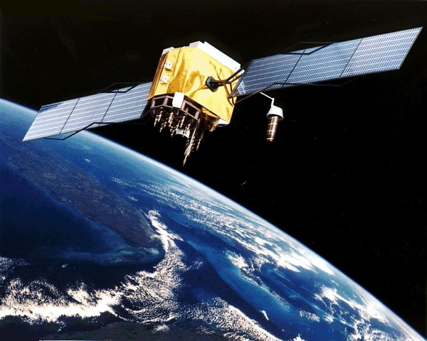
So with GPS, position is determined from satellite signals. A reasonable number of satellites are floating around the earth. Currently, there are 32 U.S. positioning satellites. These satellites continuously transmit information to the earth.
Satellite data, TLE
The information, which a GPS satellite sends is really no more than, “I am now, here.”.
This, of course, is very simplified. These satellites send this information in TLE data. TLE stands for Two Line Element, or message of two lines.
This is an example of a message from a positioning satellite:
ASTRA 2F
1 38778U 12051A 12288.95265372 .00000136 00000-0 00000+0 0 217
2 38778 000.0698 254.6769 0000479 231.1384 284.5280 01.00269150 226
So it's actually just two lines. And before that is the name. The position and time are not so easy to get from the TLE message.
But any GPS receiver can do this. That doesn't matter if it's built into a phone or if it's in professional surveying equipment.
There is a module in the GPS receivers that can make the conversion from this TLE message to an exact position of the satellite.
Position calculation by GPS receivers
Also, the GPS receiver can calculate the distance to the satellite based on the speed of the satellite signal and the difference in time the message was sent and received.
When enough satellite signals are received by the receiver, “exact” position can be determined.
Below is an image that explains this in more detail, but with two dimensions.
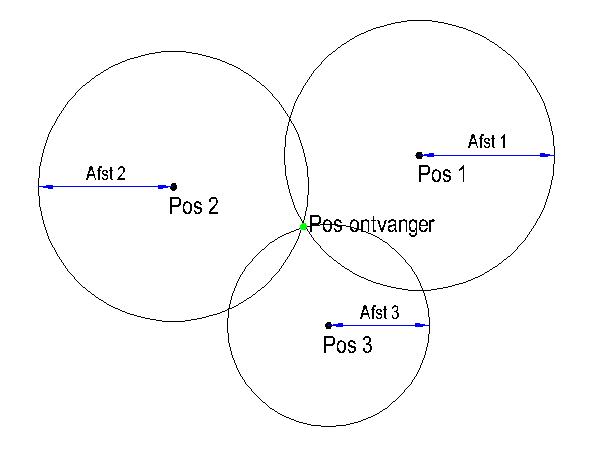
By knowing the three positions given in the figure and the three distances given in the figure, the position of the receiver can be calculated. This is what the module in the GPS receiver does.
The formula of the position on the circle is:
(x-a)2+(y-b)2=r2
Here x and y denote the position on the circle. The factors a and b are the position of the satellite. And the factor r is the distance from the satellite's position to the GPS receiver.
With three satellite positions and distances, position can be calculated using this formula when two dimensions are involved.
Only the world is a sphere. So this one is three dimensional. That means adjusting the formula to:
(x-a)2+(y-b)2+(z-c)2=r2
Additional factors are added. As a result, a minimum of four GPS satellite signals are required to determine position.
Important to know about position calculation with GPS
So, in short, the GPS satellite signals only indicate where the satellites are at that moment, and the GPS receiver, in fact, does the difficult mathematical work: positioning.
So it is important to know that the receiver does need to receive enough satellite signals, otherwise it cannot calculate a position. Satellite signals cannot penetrate buildings and trees. This must be taken into account when using GPS.
In addition, there is another uncertain factor. In the section on calculation, I described that the distance can be determined exactly because the speed of the satellite signal is known. However, the speed of the satellite signal is variable.
This is because of the Earth's atmosphere. This is constantly changing. Therefore, the speed of the satellite signal is not a constant. It is a variable. Therefore, GPS cannot determine the position exactly without a check with the position of another receiver at a fixed point.
This does not happen with the GPS receivers in a phone, so the position can be off by about 5 to 10 meters.
But in surveying, the position does get corrected by the position of another GPS receiver at a fixed point, or base station, and then the position can be determined accurately. This is up to a deviation of about 1 centimeter.
What is the difference between GPS and GNSS?
So GPS stands for Global Positioning System. But in addition to this term, people often use the term GNSS. GNSS stands for Global Navigation Satelite System.
In fact, GPS was originally an American system. But other parties also thought it was a good system and launched positioning satellites of their own.
Russia soon followed the United States. The satellites they launched they did not call GPS. They called these satellites GLONASS.
GLONASS stands for GLObalnaya NAvigatsionnaya Sputnikovaya Sistema.
But Europe, too, has now launched positioning satellites. They called these satellites GALILEO.
In addition, China also launched positioning satellites. They called them Beidou.
The beauty of this is that even though there are thus four different satellite constellations, many receivers can receive the signals from all these satellites and use them to determine position.
And because position can be determined from multiple satellite constellations and not just GPS, we therefore talk about GNSS. So this term includes not only GPS, but also GLONASS, GALILEO and BEIDOU.
And that will include other positioning satellites should they ever be launched.
Who manages the GPS system?
Managing the GPS system is fairly complicated. In fact, there are already four different satellite constellations for positioning.
And each satellite constellation has its own administrator. The administrator of GPS is the U.S. military.
The European Global Navigation Satellite System Agency manages the European GALILEO satellites. The satellites of the GLONASS and BEIDOU constellations are managed by two other parties.
So there is not a single manager of positioning satellites. There are several. In addition, there are other parties of interest. For example, these manage the conditions of communication, which are important in the positioning system.
For example, the National Marine Electronics Association is responsible for the standard way receivers send information to other systems. This is done with NMEA.
Earlier in this article I wrote about base station corrections. This is also done with a separate form of communication. This form of communication was established by Radio Technical Commission for Maritime Services.
Communication between the base stations and GPS receivers is via the RTCM communication protocol.
All these parties are important and have their role in managing their part of the GPS system. Without them, the entire system does not function properly.
Who invented GPS?
GPS is a big system. And there is actually not one inventor. There are about four people who are very important to the invention of this system.
Roger L. Easton
Roger L. Easton was the head of the space applications department at the Naval Research Laboratory. He developed various engineering applications and technologies that made GPS possible.
During the Cold War, he was working as a scientist to track Russian satellites. For this purpose, he developed a time-based navigation concept. This concept could determine positions based on circular orbits and time.
This is still vital to the positioning system.
Ivan Getting
Ivan Getting is the founder of The Aerospace Corporation. It was he who proposed a three-dimensional positioning system based on the time difference between dispatch and arrival to the U.S. Department of Defense.
The Department of Defense approved this proposal, leading to the initiative to set up the GPS system.
Bradford Parkinson
The program rigged by the Department of Defense was the NAVSTAR GPS Joint Program. At the head of this program was Bradford Parkinson. He did so from 1972 to 1978, making him the program's first manager.
At the same time, this position made him the chief architect of GPS during the design, technical development and implementation of the system.
He got a nice nickname because of this: Father of GPS.
However, he did honestly state that he used Roger L. Easton's data and calculations for development.
Gladys West
Gladys West was a female mathematician who worked on determining exact locations of satellites during the space race.

Her work is the basis for the refined calculation of the geodetic earth model, enabling GPS.
What applications of GPS are there?
GPS began as a military application. This system allowed people to fire missiles at specific targets.
In the meantime, a lot has changed. GPS is almost impossible to imagine society without and is used in many things.
For example, there is navigation. When you want to go somewhere you enter it on your phone or your navigation system, and the navigation sends you exactly to the final destination using GPS.
But navigation is much broader. GPS systems for navigation are also found in airplanes and ships.
Furthermore, GPS is also used for autonomous driving vehicles. You can think of self-driving cars. These are now in full development.
But in the agricultural sector, they are much further along. Tractors can now run entirely on GPS. This saves on labor and allows work to be done much more accurately.
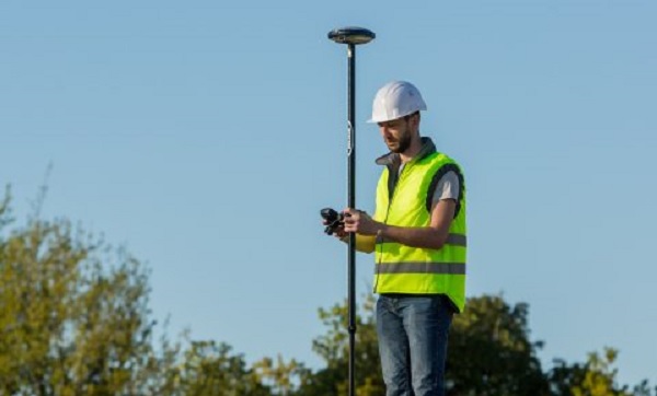
Furthermore, surveying is an application, which should not be forgotten. Land surveying is hugely important for recording objects, such as trees. But using GPS surveying, designs can also be plotted in the field.
How to work with GPS.
So people are using GPS in many areas of work. An important factor in this is the unambiguous language that receivers transmit so that machines or software can use it as a position. This language is NMEA.
NMEA consists of different rules. And these different rules represent the information calculated by the GPS receiver. This can be the position, but also the deviation, speed and direction can be indicated in these NMEA rules.
In GPS surveying, the surveying app Apglos Survey Wizard uses these NMEA rules to make them clear to the users and ensure that the user can use them for surveying applications.
Land surveying has been made very easy by Apglos Survey Wizard so that anyone can survey using this software.
And that is in line with the GPS system. In fact, this system is designed to provide an easy way to determine the position of where you are.
For surveying, this has been further developed with Apglos Survey Wizard to create the easiest land surveying solution with this software.
Final conclusion on What is GPS?
This was an entire article on What is GPS? There is a lot to report on this topic of surveying. So we hope that you have picked up at least a few things from it and can take advantage of them.
However, everything written in this article is theory. If you want to put this theory into practice you can.
In fact, you can use this website to create a measurement system try or buy. When you do then you can put into practice what you have learned by reading this article immediately. And you can see if working with our measuring equipment is something for you.
Of course, when you try or buy one of our measuring systems, you will receive a short and clear explanation so that you can get started with it right away.
If you would like a demonstration first you can book one here. With a demonstration or a brief explanation you can also ask specific questions about this topic is.
 Want to schedule a demo? You can do that through whats!