How accurate is GPS is a very good question when you want to start surveying with GPS. After all, when you are surveying, you do want the results to be accurate and precise.
A common question therefore is: how accurate is GPS? The only correct answer to the question of how accurate GPS is is that it depends on many factors and the accuracy is between a centimeter and a few decimeters. The factors that affect include the number of satellites from which the GPS receiver receives satellite signals and the position how the satellites are in relation to the GPS receiver. If the accuracy of the GPS receiver is at the centimeter level, this is an RTK fix. The other accuracy levels also have a name. Land surveying with GPS, however, requires an RTK fix, otherwise the results of the surveying will not be accurate enough. This RTK fix in GPS surveying can be obtained by using NTRIP or a local base station, among other things.
To make everything clear on this topic, we will answer the following questions in this article:
- What is the accuracy of GPS?
- What factors affect GPS accuracy?
- What are the different accuracy levels of GPS?
- What is the accuracy required for surveying with GPS?
- How is the difference in accuracy between a GPS navigation system and GPS measurement equipment obtained?
How accurate is GPS: the solution
You may not have the opportunity to read this entire article. Therefore, there is another opportunity to learn more about How accurate is GPS?.
You can try a GPS measurement system through this website. You can then see for yourself how accurate GPS is. Look directly at this page.
You can request a demonstration of one of our GPS surveying systems on the same page. At this demonstration you can then also ask specific questions about how accurate GPS is and of course other topics related to GPS surveying.
If you don't have time for a demonstration or want to try the software of our GPS measurement systems quickly in between, that is possible. Apglos Survey Wizard is the easiest software to perform GPS measurements with. You can download it for free from the Google Play Store.
The surveying app Apglos Survey Wizard has full functionality with your Android device's GPS. So you can fully test this app and it is free.
Of course, the accuracy of our GPS receivers is better than that of standard Android devices. But you can read all about that on this page. So if you want to do a test with an accurate GPS system, check out this page.
What is the accuracy of GPS?
How accurate is GPS? is a common question. Asking the question is easier than answering it. After all, GPS is not always accurate.
You have probably navigated with Google Maps before. And on Google Maps, you can see with a blue dot where you are. However in Google's Android app Maps Go, you will also see a large blue circular area around this point.
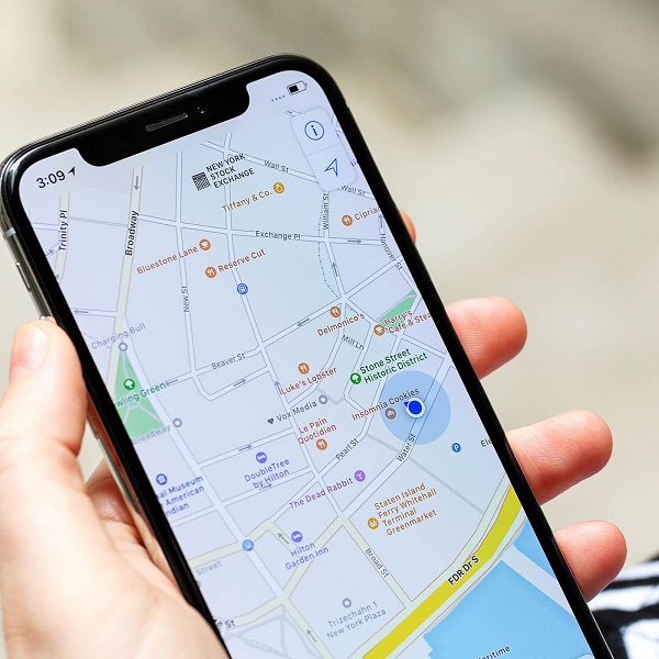
This blue round area represents the inaccuracy. The larger the round area, the more likely it is that the blue dot is not exactly the location where you are.
Should you use another app for navigation, you will probably see your position jump at times. This too indicates the inaccuracy of GPS.
As you can see in your navigation app, the accuracy of GPS is not absolute. It can vary on a phone from a few meters to a few decimeters. However, with GPS measuring devices, an accuracy of nearly a centimeter can be achieved.
What factors affect GPS accuracy?
And there is already a factor regarding the accuracy of GPS. In fact, GPS measuring equipment has a larger antenna, than a GPS in a phone. This allows GPS measuring equipment to receive more and easier satellite signals.
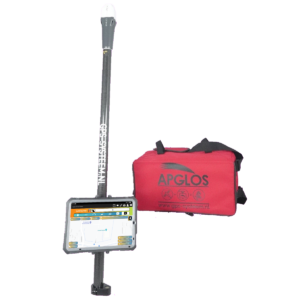
And the more satellite signals received the more accurate the position can be determined with GPS. This is also one of the reasons why GPS measuring equipment is often placed on a measuring stick of 2 meters or higher.
By placing the GPS receiver on a tall stick, the GPS receiver is less affected by obstacles. And when there are fewer obstacles, the GPS receiver can receive more satellite signals and thus determine its position more accurately.
Obstacles to GPS measuring equipment and GPS in general include tall trees and buildings. The satellite signals do not pass through these obstacles. As a result, the GPS receiver cannot receive the blocked satellite signals. This makes it more difficult for the GPS receiver to determine an exact position.
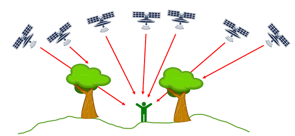
But besides the amount of satellite signals the GPS receiver receives, the position of the satellites relative to the GPS receiver is also important. If all the satellites are on one side of the GPS receiver then it is more difficult for a GPS receiver to determine an accurate position.
So a good spread of satellites is important for GPS accuracy. Fortunately, more and more satellites are coming into orbit, allowing GPS receivers to determine a position.
At first, there were only GPS satellites. But now there are also satellites of GLONASS, GALILEO and BEIDOU.
Another factor that affects GPS accuracy is the atmosphere. The satellite signals travel from the satellites through the atmosphere to the GPS receiver. The atmosphere is not always the same. Because of this, there is some interference with the satellite signals. Because of this interference, the position cannot be determined exactly with GPS without aids.
What are the different accuracy levels of GPS?
However, for navigation, the accuracy of positioning with GPS without aids is often more than sufficient.
This also makes sense because this accuracy is often around the decameter. And since a road is usually about 5 to 6 meters and there is no other road right next to it, the navigation can easily determine which road you are driving on.
Land surveying requires greater accuracy. This already shows that there are different levels of accuracy for GPS.
The beauty of GPS is that it tells itself how accurate its position is. The GPS receiver, as well as your phone, does this in the language of GPS, or NMEA. NMEA how GPS communicates position to other devices.
An important rule of NMEA is the GGA rule. This rule represents position as well as accuracy. A GGA rule looks like this:
$GPGGA,172814.0,3723.46587704,N,12202.26957864,W,2,6,1.2,18.893,M,-25.669,M,2.0,0031*4F
The different entries in a GGA line are separated by the ,-sign. When you do that for the above line you get the following:
| Number | Example | Meaning |
| 1 | $GPGGA | Type of NMEA line |
| 2 | 172814.0 | Standard time based on the atomic clock |
| 3 | 3723.46587704 | Latitude |
| 4 | N | The direction of latitude |
| 5 | 12202.26957864 | Longitude |
| 6 | W | The direction of longitude |
| 7 | 2 | GPS position quality indicator |
| 8 | 6 | The number of satellites the GPS receiver uses |
| 9 | 1.2 | HDOP |
| 10 | 18.893 | The orthometric height |
| 11 | M | The unit of orthometric height |
| 12 | -25.669 | The geoidal separation |
| 13 | M | The unit of geoidal separation |
| 14 | 2.0 | Age |
| 15 | 0031 | Reference station ID |
| 16 | 4F | End of line |
What is important for GPS accuracy is number 7, or quality indicator of GPS position.
There are different levels of quality with corresponding accuracies.
| Quality Level | Accuracy |
| RTK | 1-2 cm |
| Float RTK | 10-20 cm |
| DGPS | 1-5 m |
| SPS | >10 m |
The quality levels are indicated globally in the table above. It is an indication of what accuracy you can expect at which quality level.
What is the accuracy required for surveying with GPS?
It should be clear from the table that the highest quality level with the best accuracy is RTK. This is also the only quality level and accuracy at which you should be able to survey with GPS.
After all, you do not want to measure with higher inaccuracy at all. After all, inaccurate measurement means worse measurement results. And worse measurement results mean worse end results, which ultimately leads to higher costs.
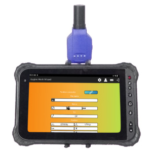
This is why all of our GPS measurement systems use the Apglos Survey Wizard software. In fact, besides being the easiest GPS measurement software, it has several advantages.
In fact, in the upper left corner of the orange bar directly above the map, you will see the GPS quality indicator.
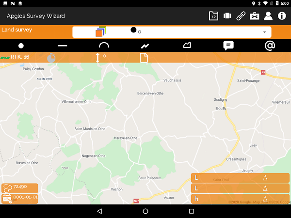
So that has to be RTK to measure accurate values with. The beauty of Apglos Survey Wizard is that you cannot in fact measure with a worse quality level. In fact, with the indications Float RTK, DGPS and SPS, you cannot measure.
This ensures that you collect only accurate measurement results. And therefore you have a good and reliable basis for the continuation of your project. And that leads to a better end result, while also saving you costs.
How is the difference in accuracy between a GPS navigation system and GPS measurement equipment obtained?
Only I described earlier that tools are needed to obtain centimeter accuracy (RTK) with GPS measuring equipment.
The atmosphere is an interfering factor for satellite signals. Therefore, when using GPS measurement equipment, the satellite signals must be compared with the satellite signals at a fixed point.
A GPS receiver is also located at the fixed point. The satellite signals received by the GPS receiver at the fixed point are compared with the satellite signals from the GPS receiver in the field. The position of the GPS receiver in the field is then corrected based on this comparison.
For example, it calculates an accurate position using GPS measurement equipment. However, the shorter the distance between the GPS receiver at the fixed point and the GPS receiver in the field, the better the correction is and the more accurate the positioning is.
This comparison can actually be done in two ways. The first is using NTRIP. In this, the GPS receiver connects via the Internet to a number of GPS receivers at various fixed points. Based on the position of the GPS receiver in the field, the distance to the various fixed points is determined. From the GPS receiver at the fixed point closest to the GPS receiver in the field you will then receive the corrections.
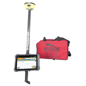
Another way is to set up your own base. A base is a GPS receiver that stands longer in one place, allowing it to determine exact and accurate position. Also with this base, the satellite signals from the GPS receiver can be corrected in the field, allowing an accurate position to be determined.
In the video above, you can see how to set up the rover basic solution to accurately measure with GPS.
Final conclusion on How accurate is GPS?
This was a whole article on How accurate GPS is. There is a lot to report on this topic of GPS surveying. So we hope you have picked up at least a few things from it and can take advantage of them.
However, everything written in this article is theory. If you want to put this theory into practice you can.
Indeed, you can use this website to purchase a GPS measurement system try or buy it. When you do then you can immediately put into practice what you learned by reading this article about how accurate GPS is. And you can see if working with our GPS measuring equipment is for you.
Of course, when you try or buy one of our GPS measurement systems, you will receive a short and clear explanation so that you can get started with it right away.
If you would like a demonstration first, you can also request one through the pages listed above. With a demonstration or a brief explanation, you can also ask specific questions about how accurate GPS is.
 Want to schedule a demo? You can do that through whats!