Measuring NAP height is important. But is it New Amsterdam Level or Normal Amsterdam Level? In any case, heights are measured relative to NAP in the Netherlands.
NAP stands for Normal Amsterdam Level. This is the height that is approximately equal to the sea level in the North Sea. The heights in the Netherlands are indicated relative to this level. By measuring NAP heights, one can make projects fit in well with the surroundings, but also prevent problems such as flooding. For NAP height measurement, one often uses a spirit level, rotating laser or GPS measuring equipment. The easiest method for NAP elevation measurement is with GPS, as it does not require a known NAP elevation.
To make everything clear on this topic, we will answer the following questions in this article:
- What is the meaning of NAP?
- What is NAP?
- How is NAP determined?
- Why is the NAP elevation important?
- What are the methods for NAP height measurement?
- Why is GPS measurement the easiest way to measure NAP elevation?
Measuring NAP height: the solution
You may not have the opportunity to read this entire article. Therefore, there is another opportunity to learn more about NAP height measurement.
You can try a GPS measurement system through this website. To do so, look directly at this page.
You can also request a demonstration of one of our GPS surveying systems. At this demonstration you can then also ask specific questions about NAP height measurement and, of course, other topics related to GPS surveying.
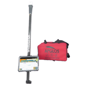
If you don't have time for a demonstration or want to try the software of our GPS measurement systems quickly in between, that is possible. Apglos Survey Wizard is the easiest software to perform GPS measurements with. You can download it for free from the Google Play Store.
The surveying app Apglos Survey Wizard has full functionality with your Android device's GPS. So you can fully test this app and it is free.
Of course, the accuracy of our GPS receivers is better than that of standard Android devices. So if you would like to do a test with an accurate system, check out this page.
What is the meaning of NAP?
There is quite a bit of confusion about the meaning of NAP. Some say NAP stands for Normal Amsterdam Level and others say New Amsterdam Level. But which is the correct one. According to the Rijkswaterstaat website, NAP stands for Normal Amsterdam Level. And that seems e a reliable source. So NAP stands for Normal Amsterdam Level.
What is NAP?
So NAP is a certain level. Relative to this level, the altitudes in the Netherlands are indicated. For example, the highest point in the Netherlands is the Vaalserberg 322.4 m above NAP. But there are also parts of the Netherlands below NAP.
So NAP is the reference plane or zero point in terms of elevation. But then the question actually remains as to what the reference plane represents. Officially, the reference plane NAP is equal to the average water level of the North Sea.
But the actual genesis of NAP is a finer story. In the 17e century, there were many floods in the Netherlands, including the All Saints Flood of 1675, and there was much flooding. The city of Amsterdam wanted to protect itself from the floods.
The Netherlands had long been familiar with building dikes. Yet Amsterdam ran into a problem. People did not know how high to build the dikes.
Therefore, people started measuring the highest water levels in the IJ daily. At that time, this was still in an open connection with the Zuiderzee, which is now IJsselmeer. People in Amsterdam measured a complete year from September 1683 to September 1684.
Of all the measurements, the average was determined. So this was the average highest flood level of the IJ. This average level was called stadspeyl, but also Amsterdams Peil.
The mayor of Amsterdam at the time, Johannes Hudde, had 8 large marble stones cemented into locks around the IJ River containing a quarry and the elevation. These were the forerunners of the now well-known level gauges.

Over the course of the 18e century, this Amsterdam Level was spread to other parts of the Netherlands. This was done by means of water adjustments. Because of the general spread, a royal decree declared the Amsterdam Level to be applicable nationwide.
In 1875, an accuracy water leveling was conducted. This led to an overall improvement in the level or reference plane. This meant that there were fewer deviations in the level.
However, it did need a new name so that everyone would use the reference level improvement as a zero point. So this is now the Normal Amsterdam Level.
How is NAP determined?
So NAP is determined by high water level measurements in the IJ. Now NAP is a fixed datum.
To make the NAP available everywhere, a grid object was created with survey marks. At the end of the 19e century, there were 4,000 level marks in the Netherlands. The level marks are managed by the Department of Public Works.
Water leveling allowed one to transfer the height of the level mark to the location where this information of elevation was needed.
With only 4,000 survey marks, these distances from the survey mark to the project site were sometimes very long. As a result, it took a long time to get the elevation to the project site and there was a high possibility of error. Every stroke (two level measurements) one could misread the staff. And when that happens then an error occurs.
Therefore, more and more level marks were placed in the Netherlands. At its peak, there were more than 35,000 level marks, which were measured by the Department of Public Works every few years by means of leveling.
Because of GPS, fewer survey markers are now needed because one can use GPS to determine the NAP elevation directly at any point.
Why is the NAP elevation important?
In the 17e century already how important it was to be able to determine the height. If they had built a dike that had been lower on one part than from another part, everything could still have flooded.
By using NAP, they could build the levees all at the same height. This allowed them to prevent floods.
Another important point to use NAP elevation is to prevent flooding. Rainwater flows after it falls to the last point. By expressing everything in NAP, for example, one can see on a drawing where the water will flow to. And if this would cause a nuisance then one can solve it immediately.
Furthermore, NAP is the same for everyone. It is the reference level. Because of this, there are no communication problems. That way, everyone can work with it.
And that fell in the 19e century even beyond the Dutch borders. As early as 1876, Prussia adopted the NAP. And then more countries followed. In 1955, for example, a number of countries established a European elevation network based on the NAP. And in 2008, the European Commission established the European Vertical Reference Frame. That frame of reference is still based on the NAP.
What methods are there for NAP height measurement?
There are a number of methods for NAP height measurement. The first one I have already mentioned. This one was used to spread the NAP across the Netherlands. This is the water leveling.
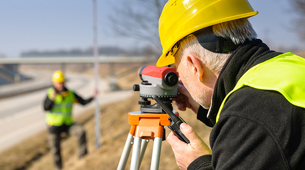
NAP height measurement with leveling
Leveling uses a level instrument and a staff. The staff is first set at a point of known height. Then one reads the staff through the leveling instrument. The staff is then moved in the direction of the project. Again, the staff is read by the leveling instrument. This whole process is called a stroke.
Then one leaves the staff in place, but moves the leveling instrument. And then one performs another stroke.
One does this until one reaches the location from which one needs the height. Then the entire section must also be measured back so that one can determine any closing error.
Measuring NAP height with a level instrument requires two people.
NAP height measurement with rotating laser
For small distances, one can measure the NAP elevation with a rotating laser. The rotating laser should then be set up in a place where one can see the point with a known NAP elevation, but where one can also see the point where one wants the elevation.
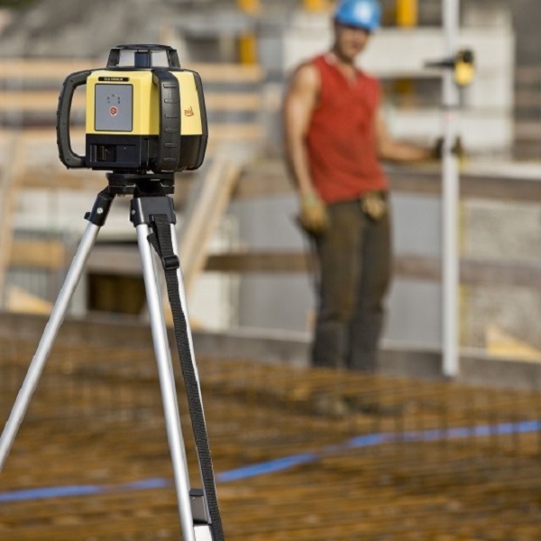
When the rotating laser is set up then one can set the staff with the receiver at the point where the elevation is known. And then one can read the receiver on the staff at the point whose NAP elevation is to be determined.
This can be performed by a single person. The distance for this method is preferably not so great. This is because it is not convenient to move a rotating laser.
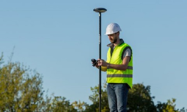
Measuring NAP height with GPS
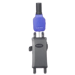
The last method I describe here is NAP height measurement with GPS. A GPS measuring system basically determines the exact location where the GPS system is.
This is what the GPS measurement system does in latitude, longitude and altitude. And that doesn't quite correspond to RD coordinates and with NAP elevation.
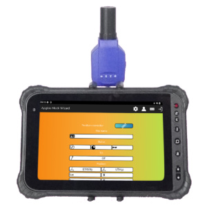
With the simple surveying software Apglos Survey Wizard, which comes with all our GPS measurement systems, these latitude, longitude and altitude are automatically converted to RD coordinates and a NAP elevation. For this purpose, the transformation determined by the Cadastre RDNAPTRANS2018 used.
Why is GPS measurement the easiest way to measure NAP elevation?
The title of this paragraph says it all. Measuring with GPS is the easiest method for NAP height measurement.
And this has to do with one important thing. Namely, when using GPS, no reference points are needed. This means that when using GPS, there is no need to subtract elevation from a survey mark.
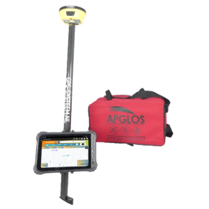
You can use all our GPS measurement systems to determine a NAP elevation at any location, as long as the GPS receiver of the measurement system receives sufficient satellite signals.
As a result, NAP height measurement with GPS works much faster. It is more effective. Only one person is needed to determine the NAP elevation with GPS.
In addition, should the methods of leveling or rotating laser be used, one often uses the point measured with GPS as a base. The latter two methods also require computation. Addition and subtraction are required, which can lead to errors.
When using GPS to measure a NAP elevation, this is not the case.
Final conclusion on NAP height measurement
This was an entire article on NAP height measurement. There is a lot to report on this topic of GPS surveying. So we hope that you have picked up at least a few things from it and can take advantage of them.
However, everything written in this article is theory. If you want to put this theory into practice you can.
Indeed, you can use this website to purchase a GPS measurement system try or buy. When you do then you can put what you learned by reading this article on NAP height measurement into practice immediately. And you can see if working with our GPS measuring equipment is something for you.
Of course, when you try or buy one of our GPS measurement systems, you will receive a short and clear explanation so that you can get started with it right away.
If you would like a demonstration first you can book one here. At a demonstration or a brief explanation you can also ask specific questions about NAP height measurement.
 Want to schedule a demo? You can do that through whats!