Measuring the height difference in a garden is important. In fact, it should be done with every new construction. But how can you measure the height difference in a garden?
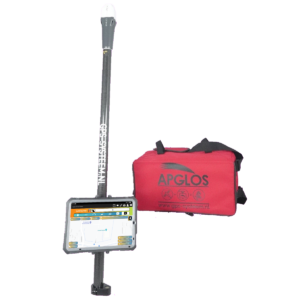
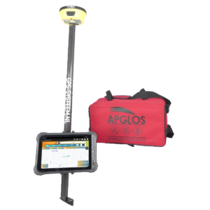
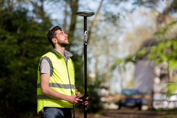
There are several methods for measuring height differences in a garden. Often it is done with a level instrument or with a rotating laser. However, measuring the height difference of a garden with GPS measuring equipment has several advantages. GPS measuring equipment is quick to set up and with Apglos Survey Wizard it is easy to use. In addition, with GPS measuring equipment, you not only get the height differences but also the coordinates.
To make everything clear on this topic, we will answer the following questions in this article:
- What are the methods for measuring a height difference in the garden?
- What are the advantages and disadvantages of different methods of measuring height differences in the garden?
- How do you measure a height difference in the garden with a level instrument?
- What should you pay attention to when measuring height differences in the garden measuring with a rotating laser?
- Why is it good to use GPS surveying equipment to measure height differences in a garden?
Measuring height difference garden: the solution
You may not have the opportunity to read this entire article. Therefore, there is another opportunity to learn more about measuring the height difference in a garden.
You can try a GPS measurement system through this website. To do so, look directly at this page.
You can request a demonstration of one of our GPS surveying systems on the same page. At this demonstration you can also ask specific questions about measuring the height difference in a garden and of course about other topics related to GPS surveying.
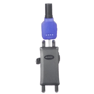
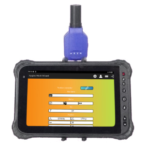
If you don't have time for a demonstration or want to try the software of our GPS measurement systems quickly in between, that is possible. Apglos Survey Wizard is the easiest software to perform GPS measurements with. You can download it for free from the Google Play Store.
The surveying app Apglos Survey Wizard has full functionality with your Android device's GPS. So you can fully test this app and it is free.
Of course, the accuracy of our GPS receivers is better than that of standard Android devices. So if you want to test with an accurate system, check out this page.
What are the methods for measuring a height difference in the garden?
Measuring a height difference in a garden can be done in several ways. All methods have their advantages and disadvantages. The choice of method for measuring the height difference in a garden is often based on how often you want to measure height differences and what information you ultimately want to obtain in addition to the height differences.
The three most common methods used to measure height differences in the garden are:
- With a leveling instrument
- On the basis of a rotating laser
- Using GPS measuring equipment
In addition, one bases the choice of method on environmental factors.
What are the advantages and disadvantages of different methods of measuring height differences in the garden?
It is therefore wise to take a closer look at the advantages and disadvantages of these three methods of measuring height differences in the garden.
The first assessment factor is the number of people than one needs to measure the height difference. With rotating laser and GPS measuring equipment, only one person is needed. However, when one wants to measure height differences in a garden with a level instrument, you always need two people. One is needed to hold the staff and one to read the staff through the leveling instrument.
Lines of sight are required for both the level instrument and the rotating laser. For the level instrument, there should be no obstructions between the level instrument and the staff, because then one cannot read the staff.
For a rotating laser, the receiver must be able to see the laser. Also there should be no obstacles between the receiver and the rotating laser.
GPS measuring equipment does not suffer from low obstacles. High obstacles can bother GPS measuring equipment. The GPS receiver must receive sufficient satellite signals to determine the exact position. Trees and high buildings can prevent the GPS receiver from receiving enough satellite signals. And as a result, the GPS receiver cannot determine its exact position. So under a canopy, one cannot measure with GPS measuring equipment.
Then there is the start-up time to get the equipment to measure the height difference in the garden. For both the rotating laser and the leveling instrument, they must be perfectly level. If they are not set up horizontally then deviations in the measurement results occur.
This causes these measurement systems to take longer to set up. This is not necessary when measuring height differences in the garden with GPS measuring equipment. With GPS measuring equipment, you actually only need to turn on the system and you can immediately measure the height difference in the garden.
That is part of the convenience of GPS measuring equipment. But in addition, with GPS measuring equipment, you don't have to do the math yourself. With the spirit level instrument and rotating laser, you do have to do so to determine height differences. Calculation can cause errors.
These advantages and disadvantages are put in the table below.
| Leveling tool | Rotating laser | GPS measuring equipment | |
| Required number of people | — | ++ | ++ |
| Low obstacles | — | — | ++ |
| High obstacles | – | – | — |
| Setup time | — | – | ++ |
| Ease of use | – | ++ | ++ |
The table shows that GPS measuring equipment is often the best method for measuring height differences in the garden. It should be noted, however, that GPS measuring equipment is often more expensive than a level instrument or a rotating laser.
How do you measure a height difference in the garden with a level instrument?
As described, measuring height differences in the garden with a level instrument consists of two main parts. The first component is the leveling instrument itself.
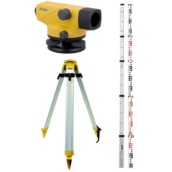
And the other is a staff. On the staff is a scale. And based on this scale the height can be determined.
The height difference is determined by setting the staff at the first point and reading the measure using the cross wires in the leveling instrument.
Then the staff can be placed in the second position. Also at this position, the measure should be read on the staff.
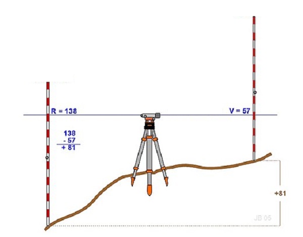
When the two measurements are subtracted from each other, one gets the height difference.
When measuring height differences in the garden with a spirit level instrument, there are a few important things, though. First, care must be taken not to move the leveling instrument.
It is also important that the leveling instrument be level in all directions. When this is not done then deviations occur.
What should you pay attention to when measuring height differences in the garden measuring with a rotating laser?
A rotating laser in itself works the same as the leveling instrument. Only the rotating laser emits a laser beam that a receiver receives.
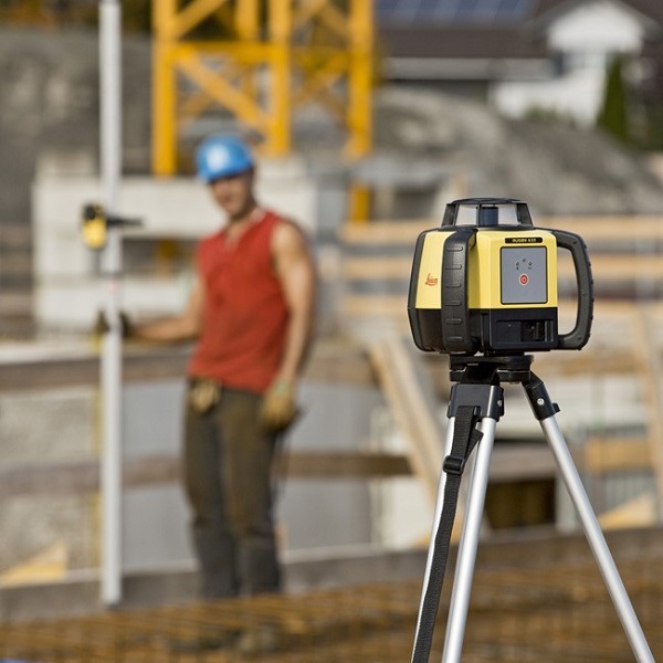
This receiver is often attached to the staff and by moving the receiver on the staff, one can determine the height of the point relative to the rotating laser. By determining the height of two points relative to the rotating laser, one can calculate the height difference between them.
Again, it is important that the rotating laser is set up straight. It is also important that there are no obstacles between the rotating laser and the two points over which the height difference is to be determined. Thus, there must be two unobstructed lines of sight.
In addition, every decent rotating laser comes with protective glasses. This is because it is not wise to look directly into the laser beam.
Why is it good to use GPS surveying equipment to measure height differences in a garden?
The table in this article shows that measuring height differences in a garden with GPS measuring equipment has many advantages. But are other reasons that it is useful to measure height differences in a garden with GPS measuring equipment.
In fact, when measuring with GPS measuring equipment, one does not just measure altitude. In GPS measuring, one establishes a coordinate. A coordinate is a point recorded in x, y and z directions. Because of this fixation of the point, much more can be done with it.
Also, by recording coordinates with GPS measuring equipment, the elevation in the garden can be done later. When working with a leveling instrument or rotating laser, the height should be calculated immediately.
Another advantage is that the coordinate data from the GPS measuring equipment can be stored directly in a drawing or database. This allows one to see at a later stage if the work was done properly and makes it easier to solve any problems.
Also, storing the coordinate data reduces the need to measure the elevation difference. In fact, there is no need to determine elevation when the elevation is recorded.
Final conclusion on height difference garden measurement
This was a whole article about measuring an elevation difference in the garden. There is a lot to report on this topic of GPS surveying. So we hope that you have picked up at least a few things from it and can take advantage of them.
However, everything written in this article is theory. If you want to put this theory into practice you can.
In fact, you can try or buy a GPS measuring system through this website. When you do then you can immediately put into practice what you have learned by reading this article about height difference garden measurement. And you can see if working with our GPS measuring equipment is something for you.
Of course, when you try or buy one of our GPS measurement systems, you will receive a short and clear explanation so that you can get started with it right away.
If you would like a demonstration first, you can also request one through the pages mentioned above. With a demonstration or a brief explanation you can also ask specific questions about measuring the height difference in the garden.
 Want to schedule a demo? You can do that through whats!