Land surveying consists of measuring or plotting. It is also sometimes called measuring and setting out. Measuring and setting out is the basis of all building projects in the Netherlands. By measuring and plotting properly, new building projects can be fitted precisely into the existing situation.
Measurement and surveying are important parts of surveying. Measuring, also known as measuring, involves mapping the existing situation. And setting out is marking predetermined coordinates in the field so that construction projects can be built and constructed based on these points. Measuring and plotting can be done in a variety of ways. For example, it can be done with a measuring tape or with a total station. But increasingly people are measuring and plotting with GPS. Besides a good GPS measuring system, it is useful for measuring and plotting with GPS to have a drawing program with which the measurements can be further elaborated and where the elements to be plotted can be prepared.
To make everything clear on this topic, we will answer the following questions in this article:
- What is measuring and plotting?
- What is measuring and plotting for?
- What are the methods for measurement and plotting?
- How to measure and plot with GPS?
- Besides a GPS system, what else is needed to measure and plot?
Measuring and plotting: the solution
You may not have the opportunity to read this entire article. Therefore, there is another opportunity to learn more about measurement and plotting.
You can try a GPS measurement system through this website. To do so, look directly at this page.
You can request a demonstration of one of our GPS surveying systems on the same page. At this demonstration you can then also ask specific questions about measuring and surveying and of course about other topics related to GPS surveying.
If you don't have time for a demonstration or want to try the software of our GPS measurement systems quickly in between, that is possible. Apglos Survey Wizard is the easiest software to perform GPS measurements with. You can download it for free from the Google Play Store.
The surveying app Apglos Survey Wizard has full functionality with your Android device's GPS. So you can fully test this app and it is free.
Of course, the accuracy of our GPS receivers is better than that of standard Android devices. So if you want to test with an accurate system, check out this page.
What is measuring and plotting?
What is measuring?
Land surveying consists of measuring and plotting. Another word for measuring is gauge. Measuring is not just measuring distances, lengths and areas. No, in surveying it is important, that what is measured is measured in relation to other points.
This is why people work with coordinates in surveying. In the Netherlands RD coordinates are used. You can read more about RD coordinates in this article.
Measuring with coordinates ensures that the position of an object is recorded relative to other objects. The measured objects are actually mapped.
By objects you can think of trees, but also of buildings, roads, light poles, trash cans. In fact, everything you see outside is measured.
After measuring these objects, the measurement goes inside. Inside the office, one then creates a complete map or subsurface of everything that has been measured.
What is expansion?
And besides measuring, there is plotting. Plotting is actually the exact opposite of measuring. Whereas when measuring objects outside one goes to a map, when plotting a map or design one goes to marking the location in the field.
At the time of plotting, the object is often not yet in the field. By marking the location, one can later place the object at the marked location. This object can again be anything. Again, you can think of trees. But also building pits, water courses, paving are marked.
Marking is often done with pickets, nails or with paint. The type of marking is determined based on the surface. When placing marking points in the sand, it is not convenient to work with nails or with paint. This is because the intention is to keep the marker point visible for some time after it is set out. And with nails and paint on sand, this is not the case.
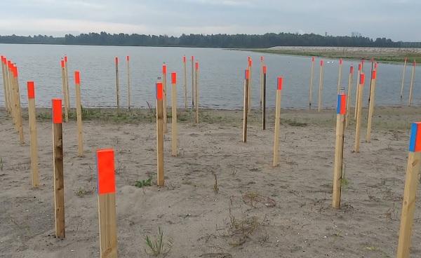
Even with wooden pickets, there is frequently the problem of them being knocked over during construction work. This happens mainly when there is a lot of equipment on the job.
Plotting must therefore be redone regularly. It is therefore useful to have a GPS measuring system at work, so that the markers can be quickly repositioned after they are no longer visible for whatever reason.
What is measuring and plotting for?
The Netherlands is constantly evolving. This means that there is continuous construction. And when a new structure or road is to be built, of course it must fit into the existing situation.
This is why measuring and plotting is enormously important. Measuring creates a map or substrate that is the basis of a design for a structure, road or garden.
The designer fits the new design to this substrate. And when the design is ready and construction begins, there comes the staking out. Plotting ensures that the design is laid out in the right position in the field.
Measuring and plotting is therefore enormously important for fitting new works into the existing situation. And measuring and setting out occurs in many disciplines. You can think of the ground, road and hydraulic engineering sector. But you can also think of building contractors, landscapers and all parties who manage outdoor spaces.
In fact, for management purposes, another measurement is important after implementation. This is the revision measurement. A revision measurement involves mapping everything that has been newly constructed. Based on this map, a manager can make decisions at a later date.
What are the methods for measurement and plotting?
The importance of measuring and plotting may be obvious. But there are different methods for measuring and plotting.
Measuring with a tape measure
First, there is the old tape measure. The tape measure is easy to use. You fix the tape measure at a known point and read the distance on the tape measure at the object you want to measure. When you do this for the same object from several known points, you can record the object relative to these known points.
Measuring and plotting with a tape measure does have some disadvantages. The result of measuring with measuring tape are distances relative to known points and therefore not the desired coordinates. You can only find out the coordinates if the coordinates of the known points are properly recorded.
In addition, for proper measurement, the tape measure should always be tight when you read it. This is not always possible. This increases the inaccuracy factor. Measuring and plotting with tape measure also does not take into account heights.
In short, measuring and plotting with a tape measure is good for an indication, but it is not accurate nor does it work very quickly.
Land surveying with a total station
Fortunately, there are other methods to measure and plot with. One is the total station. A total station works with angles and distances. Like a tape measure, it assumes known points.
As with the tape measure, when measuring and plotting points with a total station, it is important to get the coordinates of the known points right.
When these are correct then the result of a total station can be accurate to the millimeter. However, if the coordinates of the known points are not correct, then the margin of error of such a base point works through the entire measurement.
Surveying with a total station is also a profession. Before a person can handle a total station, he must be properly trained to do so. And this is not everyone.
Measuring and plotting with a total station can lead to good results only when performed by professionals.
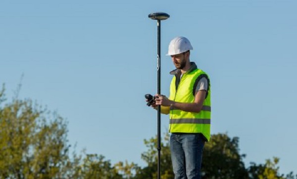
Land surveying with GPS
Unfortunately, professionals who can handle a total station are scarce. Fortunately, there is also the possibility of measuring and plotting with GPS.
GPS is tremendously easy for positioning. Everyone uses it for navigation. When it comes to centimeter-accurate positioning, GPS is a little more complicated.
But Apglos has made it very easy with the land surveying application Apglos Survey Wizard. As a result, surveying and plotting with GPS is now accessible by everyone. You can download Apglos Survey Wizard itself from the Google Play Store.
With GPS measurement, an error in a previously measured point does not affect the rest of the result. Also, setting up GPS measuring equipment is much faster than setting up a total station. So there are many advantages of GPS measuring equipment over a total station.
However, there are also a few drawbacks. Only when the GPS system receives sufficient satellite signals can you measure and plot with a GPS system. Thus, GPS cannot be used to measure in tunnels and under overpasses.
Fortunately, there are more and more satellites, which GPS receivers can use to determine position. Still, the maximum accuracy of GPS remains at centimeter level. This is somewhat less than with a total station. But for most applications of measuring and plotting, GPS is very suitable.
How to measure and plot with GPS?
So measuring and plotting with GPS is the best solution. It is accurate to the centimeter and it is easy to use.
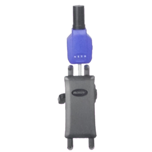
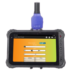
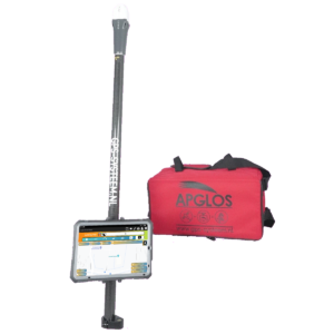
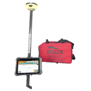
A GPS measuring system consists of a GPS receiver, a GPS measuring stick, a tablet, a tablet holder, some accessories. However, the most important thing is the software. With the software you control the entire measuring system.
So the software must be easy to use. And that's why all of our GPS surveying systems include the surveying app Apglos Survey Wizard. This app makes it accessible to measure and plot with GPS.
But how exactly does measuring and plotting with GPS work? It is natural to turn on all the components and turn on Apglos Survey Wizard. Then a connection must be made between Apglos Survey Wizard and the GPS receiver. The video below shows the explanation of Apglos Survey Wizard's connection screen.
After a connection is established, measuring is very easy. The video below shows the explanation of Apglos Survey Wizard's measurement screen.
And then there is plotting. When evicting, you need to make sure that the objects to be evicted are in Apglos Survey Wizard. You can do this by opening a DXF, TXT, CSV file. But you can also manually output coordinates yourself.
Then on the plotting screen you can select the objects. On the left side of the screen, you will see an arrow with the direction to the point. And below that, you will see the distance to the point and the height difference from the point.
You then only need to walk so that the distance equals 0. As you can read, it is very simple. And this is how measuring and surveying with GPS works.
Besides a GPS system, what else is needed to measure and plot?
Above is a brief description of how to measure and plot with GPS. So you need a GPSS measuring system for that.
But it is helpful if you have even more. For measuring, it is important to convert the measurement to a clear drawing. Of course, Apglos Survey Wizard works with layers. And with this surveying app, you can save the measurement data as DXF.
This makes the measurement data from Apglos Survey Wizard easy to use in drawing programs such as Microstation and AutoCAD. Of course, there are other drawing programs you can use as well.
If you really want to get the most out of a GPS system for measuring and plotting, a drawing program is necessary. This is because a drawing program allows you to elaborate on the measurement data.
In addition, a drawing program is also very useful when plotting. In fact, with a drawing program you can place the objects in a file, which you can easily plot with your GPS system with Apglos Survey Wizard.
However, you should know that you do not need to be a professional draftsman. You only need to know the basics of the drawing program. For this you can also take a course with us.
Ask about the possibilities for that.
[contact-form-7 id=”913″ title=”Contact”]
In addition to the drawing program, you will need marking materials, such as stakes, nails or paint, for plotting. And, of course, you will need tools to apply the marking material.
But that's about it. So to start measuring and plotting with GPS yourself, you don't need much.
Final conclusion on measurement and plotting
This was a whole article about measuring and plotting. There is a lot to report on this topic of GPS surveying. So we hope you have picked up at least a few things from it and can take advantage of them.
However, everything written in this article is theory. If you want to put this theory into practice you can.
In fact, you can try or buy a GPS measuring system through this website. When you do so then you can immediately put into practice what you have learned by reading this article about measuring and plotting. And you can see if working with our GPS measuring equipment is something for you.
Of course, when you try or buy one of our GPS measurement systems, you will receive a short and clear explanation so that you can get started with it right away.
If you would like a demonstration first, you can also request one through the pages mentioned above. With a demonstration or a brief explanation you can also ask specific questions about measurement and plotting.
 Want to schedule a demo? You can do that through whats!