Do you want to survey something? Then you may be thinking of hiring a surveyor. But before you possibly decide to do that read this article. You can also do your own surveying. This is more economical, has other advantages and you will get exactly the same results as a professional surveyor.
Land surveying is mapping objects in the field. You can also locate points in the field. This is called plotting. For most surveying work, you do not need a surveyor. In fact, you can survey by yourself. In fact, GPS surveying is very easy with our GPS surveying systems including the easiest surveying software Apglos Survey Wizard. Anyone can survey with it.
To make everything clear on this topic, we will answer the following questions in this article:
- How can you land yourself?
- What do you need to do your own surveying?
- Do you need training to do your own surveying?
- When is it better to hire a surveyor anyway?
- What is the difference in cost between surveying yourself and hiring a surveyor?
- What are other advantages to surveying yourself?
Surveying yourself: the solution
You may not have the opportunity to read this entire article. Therefore, there is another opportunity to learn more about self surveying.
You can try a GPS measurement system through this website. To do so, look directly at this page. Then you can start surveying yourself right away.
You can request a demonstration of one of our GPS surveying systems on the same page. At this demonstration you can then also ask specific questions about surveying yourself and of course about other topics related to GPS surveying.
If you do not have time for a demonstration or just want to try the best software for this GPS receiver that is possible. Apglos Survey Wizard is the easiest software to do your own surveying. You can download it for free from the Google Play Store.
The surveying app Apglos Survey Wizard has full functionality with your Android device's GPS. So you can fully test this app and it is free.
Of course, the accuracy of our GPS receivers is better than that of standard Android devices. So if you would like to do a test with an accurate system, check out this page.
How can you land yourself?
There may be times when you want to survey something. For example, you want to determine the property line of your plot. Or you want to know exactly how high the street level is. Or you want to know exactly where the fence is.
Your first thought is probably to hire a surveyor. But actually, that's not the right first thought.
In fact, in many cases, you can survey yourself. In fact, surveying is not difficult at all.
In fact, we make GPS surveying accessible to you, both in affordability and ease of use.
That sounds like a great promise. But the great thing is that we can also deliver on this promise.
In fact, with our GPS surveying systems, anyone can survey. This is due to our in-house developed software Apglos Survey Wizard.
Apglos Survey Wizard is GPS surveying software aimed at making surveying as easy as possible. This software is very user-friendly. The layout of the surveying software is intuitive. This allows you to quickly get up to speed with Apglos Survey Wizard for surveying.
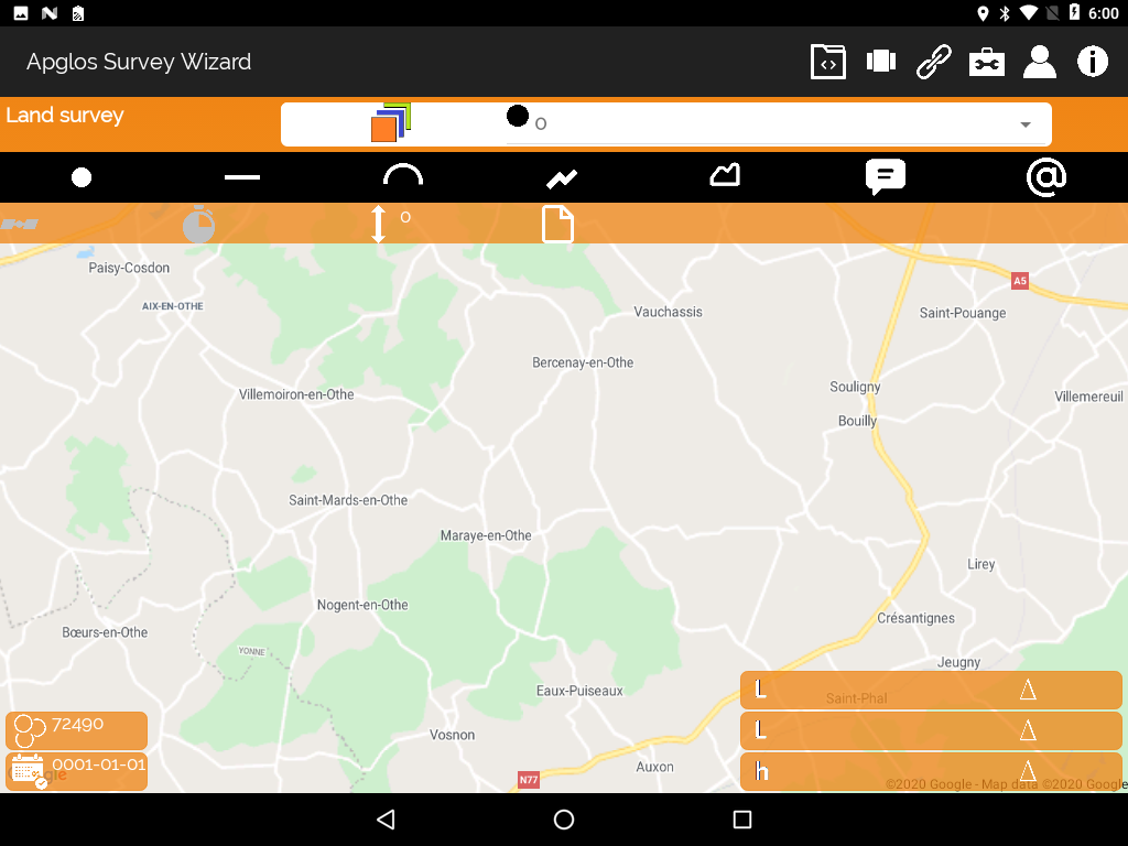
You can also try this out for yourself. In fact, Apglos Survey Wizard is free to download from the Google Play Store.
Also in terms of cost, surveying yourself is much more economical than hiring a surveyor. But I write more about that later.
What do you need to do your own surveying?
First, let's see exactly what you need to do your own surveying. You do need more than just the land surveying software Apglos Survey Wizard on your phone or a tablet.
This is because the GPS of a phone or a tablet is not very accurate. The purpose of the GPS in a phone or a tablet is mainly to navigate. And when navigating by car or bicycle, having a deviation of about 5 to 10 meters is not a big deal.
In surveying, that's a big deal. After all, that's where you want to work with centimeter accuracy.
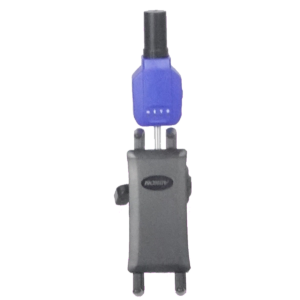
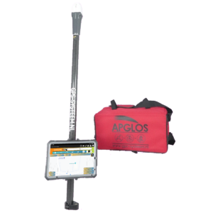
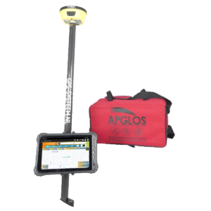
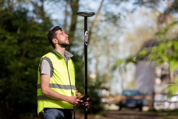
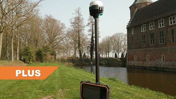
Therefore, GPS surveying is always used with a GPS measuring stick. The most important part of a GPS measuring stick with respect to accuracy is the GPS receiver.
There is a larger antenna in the GPS receiver than in a phone or tablet. This allows a GPS receiver to receive more satellite signals. Also in such a GPS receiver is a more powerful calculation module to determine the position from satellite signals more accurately.
Such a GPS receiver works best when there are no obstacles between the receiver and the GPS satellites. Therefore, the GPS receiver is placed on a lead rod. This is often a 2-meter long stick. By placing the GPS receiver on this perpendicular, it is unaffected by most obstacles, which are often low to the earth's surface.
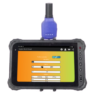
So in addition, of course, you will also need a tablet or phone with the land surveying software Apglos Survey Wizard.
But in most cases, it is not convenient to hold the lead rod in one hand and the tablet or phone in the other. This is why a complete GPS measuring stick also includes a tablet holder, which attaches the tablet to the plumb rod.
Those are all the parts you can actually see with a GPS measuring stick. But to do a self survey you need two more things. One is a connection to the RTK correction network.
The connection to the RTK correction network allows you to take centimeter-accurate land measurements. Without this connection, accuracy will be stuck at a few decimeters, even though you are working with a professional GPS receiver. How an RTK correction network works you can see here reading.
To connect to the RTK correction network, you need an Internet connection. The easiest way to do this is with a SIM card in the tablet.
Now it may seem that you need a lot to survey yourself. And that you need to arrange a lot. But not so, because we have already put together complete GPS surveying systems for you for rental and buy, which you can immediately start working with yourself.
Do you need training to do your own surveying?
Many things require real training. And while there are plenty of courses to become a surveyor, you don't need to have training in surveying to work with our GPS measurement systems.
In fact, when you buy or rent a GPS surveying system from us, we make sure that everything is set up properly. You do not have to worry about ellipsoids, geoids, coordinate systems, etc., which you are taught about in a surveyor training course.
Connecting between the GPS receiver and the surveying software Apglos Survey Wizard is also easy. Once the GPS Receiver and the software are booted up, you can connect between the software and the GPS Receiver with just three clicks. This includes connection to the RTK correction network.
In addition, there is a special feature in Apglos Survey Wizard. This function is called guided tour. And in this function, you can choose what you want to do in two steps. Then you perform exactly what the surveying software Apglos Survey Wizard tells you.
This allows you to learn very quickly with the software how to perform various functions within surveying. Here you can think of measuring a point or measuring a line object. But you can also learn how to stake out points using this function.
In addition, when you rent and purchase a GPS measurement system from us, you will receive a brief explanation of the GPS measurement system focused on the tasks, you want to perform.
Thus, to use our GPS measurement systems, you do not need training as a surveyor.
In fact, you will get the same results as a professional surveyor using a GPS measurement system.
When is it better to hire a surveyor anyway?
It should be clear from this article that you can indeed do land surveying yourself. In some cases, it may still be better to hire a surveyor to perform the surveying work.
An example is when there is a conflict between you and another party.
A GPS measurement system does not lie. The position, which it indicates, is the actual position with a corresponding deviation. When you have an RTK fix it is only a centimeter.
However, in conflicts, there may be a dispute about the quality of surveying when you do it yourself, even if the results are the same as those of a professional surveyor.
But when you have an impartial surveyor, who has no relationship with either party in the conflict, perform the surveying work, both parties are more likely to acquiesce to the surveyor's result. As a result, there is less chance of the conflict escalating.
Another situation for which you are better off hiring a surveyor than doing it yourself is when the surveying work needs to be done in a location where there are many obstacles. By obstacles here I mean large trees, large buildings, canopies, etc..
GPS works only when the GPS receiver can receive enough GPS signals. If a GPS receiver receives too few GPS signals then it cannot accurately determine position. And when the position is not accurate, it cannot land accurately.
The technology of GPS is improving every time, reducing the burden of obstacles in GPS.
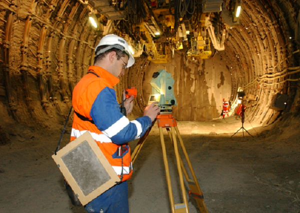
However, under a shelter or canopy, GPS cannot be used to measure properly. A surveyor has other surveying instruments in addition to a GPS measurement system. This allows him to measure at these locations with obstacles. This is therefore a reason to hire a surveyor.
But beyond these reasons, you can actually always survey yourself. After all, that also saves on costs.
What is the difference in cost between surveying yourself and hiring a surveyor?
On our website we are very clear what the costs are for our GPS measurement systems. This applies to both renting and buying the GPS measurement systems.

The cheapest GPS measurement system on our website including all subscriptions is around € 2920,- excl. VAT. And renting a GPS measuring system is about € 50,- excl. VAT per day plus the start-up costs of € 50,- excl. VAT.
For current prices, see the buy page and the rental page.
A surveyor also has certain fees. For this article on surveyors, we researched surveyor prices at the time.
The hourly rates we found for 2020 are:
- GPS surveyor: € 61.50 excl.
- Surveyor with full surveying instruments: € 77.50 excl. VAT
These rates will certainly not have gone down by 2021.
In addition, a surveyor almost always settles in dayparts. The cost for a half-day of the two types of surveyors is then as follows:
- GPS surveyor: € 246 excluding VAT
- Surveyor with full surveying instrumentation: € 310, - excluding VAT.
This means that when you want to survey something and do it yourself you always save. When you rent a GPS surveying system from us you already save € 146,- excl. VAT per half day compared to a GPS surveyor. And when you have surveying work for a whole day you save € 392,- excl. VAT per day compared to a GPS surveyor.
And if you have a long-term project that requires land surveying on several days, then surveying yourself is also more economical. The purchase of a complete Start GPS measuring system including subscriptions costs less than hiring a GPS surveyor for 12 half-days.
The beauty of having your own GPS surveying system is that you can use it more often at no extra cost. And the more often you survey yourself, the more you save.
What are other advantages to surveying yourself?
But besides the fact that surveying yourself is more economical, surveying yourself has other advantages over hiring a surveyor.
First, there is the impact on scheduling. When you survey yourself, you can decide when to do it. Whereas when you hire a surveyor, you have to arrange this in a timely manner. The last time I asked a surveyor if he could survey something, the surveyor indicated that the first opportunity he had to do it was in three months.
Most people are not waiting for such a long waiting period. But this is something you do not have to take into account when you start surveying yourself.
Another advantage is that when you do the surveying work yourself, you also do it the way you want it and you mean it. When you have to communicate it with a surveyor first, you may always not get exactly what you want.
Or that, and this is no less bad, that you have to pay more than was agreed upon, because the surveyor sees this as adjustment and therefore as additional work.
Furthermore, when you measure yourself, the quality often goes up. After all, you have the goal in mind, while for the surveyor it is just another job. And not only that. When you are surveying yourself, you also see more. And when you see more, you often want to measure more. This gives you a more complete survey.
And when you have a more complete surveying then you have a higher quality surface. This improves the quality of your entire project.
Final conclusion on self surveying
This was a whole article on self surveying. There is a lot to report on this topic of GPS surveying. So we hope that you have picked up at least a few things from it and can take advantage of them.
However, everything written in this article is theory. If you want to put this theory into practice you can.
In fact, you can try surveying a GPS measurement system with a Reach RS2 through this website. When you do that then you can put what you read in this article into practice immediately. And you can see if working with a GPS measuring system is something for you.
Of course, when you try or buy one of our GPS measurement systems, you will receive a short and clear explanation so that you can get started with it right away.
If you would like a demonstration first, you can also request one through the pages mentioned above. With a demonstration or a brief explanation you can also ask specific questions about surveying yourself.
 Want to schedule a demo? You can do that through whats!