Description
Step into the world of precision surveying with the Pro GPS land surveying system! The Pro GPS system offers an advanced solution for all your surveying needs. With the innovative ProNivo PNR21i, you have the ability to take oblique measurements, allowing you to take accurate measurements even in hard-to-reach areas. Discover how the Pro GPS system can help you measure terrain more efficiently and effectively, no matter the conditions.
Advantages
The Pro GPS measurement system has many advantages, including:
- Accuracy: GPS land survey systems offer high accuracy in determining locations and taking measurements, enabling precision work.
- Flexibility: GPS surveying systems are suitable for different terrains and conditions, making them flexible for a variety of projects.
- Accessibility: GPS technologies can be used to measure areas that were previously difficult to access, allowing measurements in remote locations.
- Cost savings: Although GPS land surveying systems require initial investment, they can be cost-saving in the long run because of increased efficiency and accuracy.
Applications
GPS measurement systems are used in such areas as:
- Land surveying and cadastral mapping: GPS land surveying systems provide accurate measurements for mapping plots, establishing property boundaries and recording cadastral data, which is essential for property management and legal purposes.
- Environmental research: GPS systems enable environmental scientists to track changes in landscape, flora and fauna, which is essential for ecosystem conservation, natural resource management and understanding environmental change.
- Soil Survey: Soil scientists use GPS systems to analyze soil conditions, soil characteristics and land use, which is important for agricultural practices, soil erosion management and land assessment.
- Property Management: For real estate professionals, GPS systems provide an accurate way to capture property boundaries, record site data and facilitate real estate transactions by providing detailed maps and measurements.
- Military operations: In the military, GPS systems are used to map strategic locations, coordinate troop movements and provide navigational support during military operations and missions.
- Urban development: In urban areas, GPS systems are used to plan new neighborhoods, develop infrastructure projects and promote sustainable urban development for growing populations.
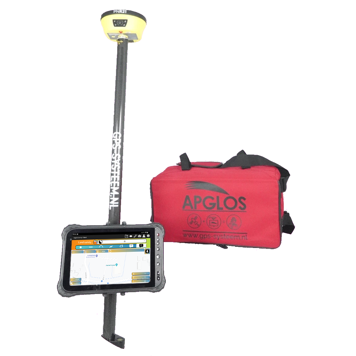
Content
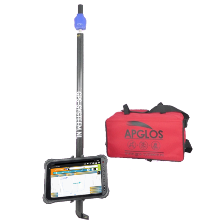
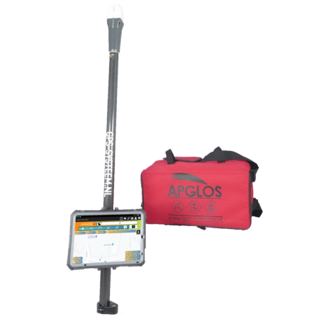
The Pro GPS measurement system consists of the following components:
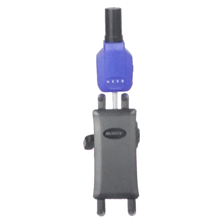
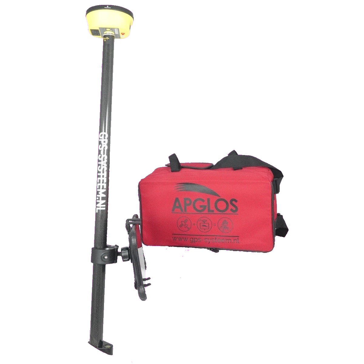
- PNR21i (tilt): Enables accurate measurements at different angles, even in hard-to-reach locations.
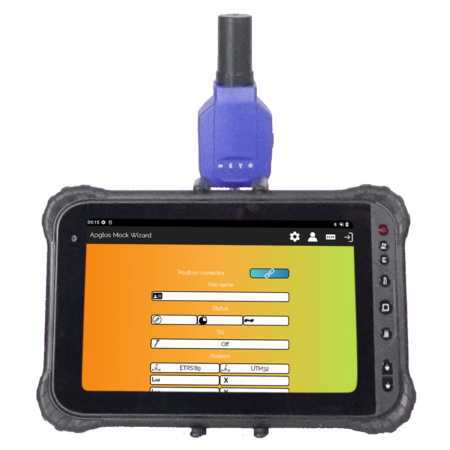
- T8-20 (rugged Android tablet): Provides advanced features and smooth performance for efficient working with various applications and tools.
- Apglos Survey Wizard subscription package: Provides access to regular updates, new features and enhancements to always stay up-to-date with the latest developments in surveying technology.
- Tablet Holder: Provides secure and stable tablet attachment for hands-free measurements.
- GPS lead rod 2.0 m, carbon, screw-on: Lightweight and durable design with easy installation and adjustment for different measurement needs.
- Bag large: Provides enough space to safely store all components and easily transport them to different locations.
Professional precision at your fingertips: With the Pro GPS system, you are assured of accurate measurements even under the most challenging conditions. Rely on its advanced features and reliable performance to make any surveying project a success.