Description
Long description:
Discover the ultimate solution for accurate surveying with the Plus GPS system! Are you looking for a reliable and accurate way to take land measurements? The Plus GPS surveying system offers just what you need. With its advanced technology and user-friendly design, this system allows you to measure terrain quickly and accurately, without the hassle. Find out how the Plus GPS system can help you with all your surveying challenges.
Advantages
Working with the Plus GPS measurement system has many advantages. Some of them are:
- Accuracy: GPS land survey systems offer high accuracy in determining locations and taking measurements, enabling precision work.
- Efficiency: The use of GPS systems makes site measurement and mapping faster and more efficient compared to traditional methods such as manual measurement.
- Real-time data: GPS systems can provide real-time data, allowing rapid decision-making during fieldwork.
- Data integration: GPS systems can easily integrate data with GIS (Geographic Information Systems) and CAD (Computer Aided Design) software, enabling seamless data analysis and visualization.
Applications
There are many applications you can use a GPS measurement system for. Some of these are:
- Land surveying and cadastral mapping: GPS land surveying systems provide accurate measurements for mapping plots, establishing property boundaries and recording cadastral data, which is essential for property management and legal purposes.
- Precision Agriculture: In the agricultural sector, GPS systems enable farmers to work at the plot level, optimizing seeding, fertilization and irrigation practices by identifying variations in the field and conducting targeted farming operations for maximum yields.
- Construction Projects: GPS surveying systems play a crucial role in construction projects by providing accurate location data for setting foundations, checking structures and planning infrastructure developments such as roads, bridges and buildings.
- Forestry and conservation: GPS systems are used by forest managers and conservationists to monitor forests, protect habitats and manage wildlife populations, enabling sustainable forest management and biodiversity conservation.
- Road and rail maintenance: In road and rail management, GPS systems help with inspection and maintenance of transportation infrastructure, such as checking road quality, planning maintenance programs and managing rail networks.
- Energy and utilities: For energy and utility companies, GPS systems provide a way to map pipes, cables and energy infrastructure, optimize utility network management and quickly locate and repair faults.
Content
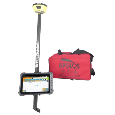
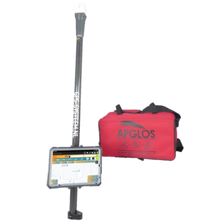
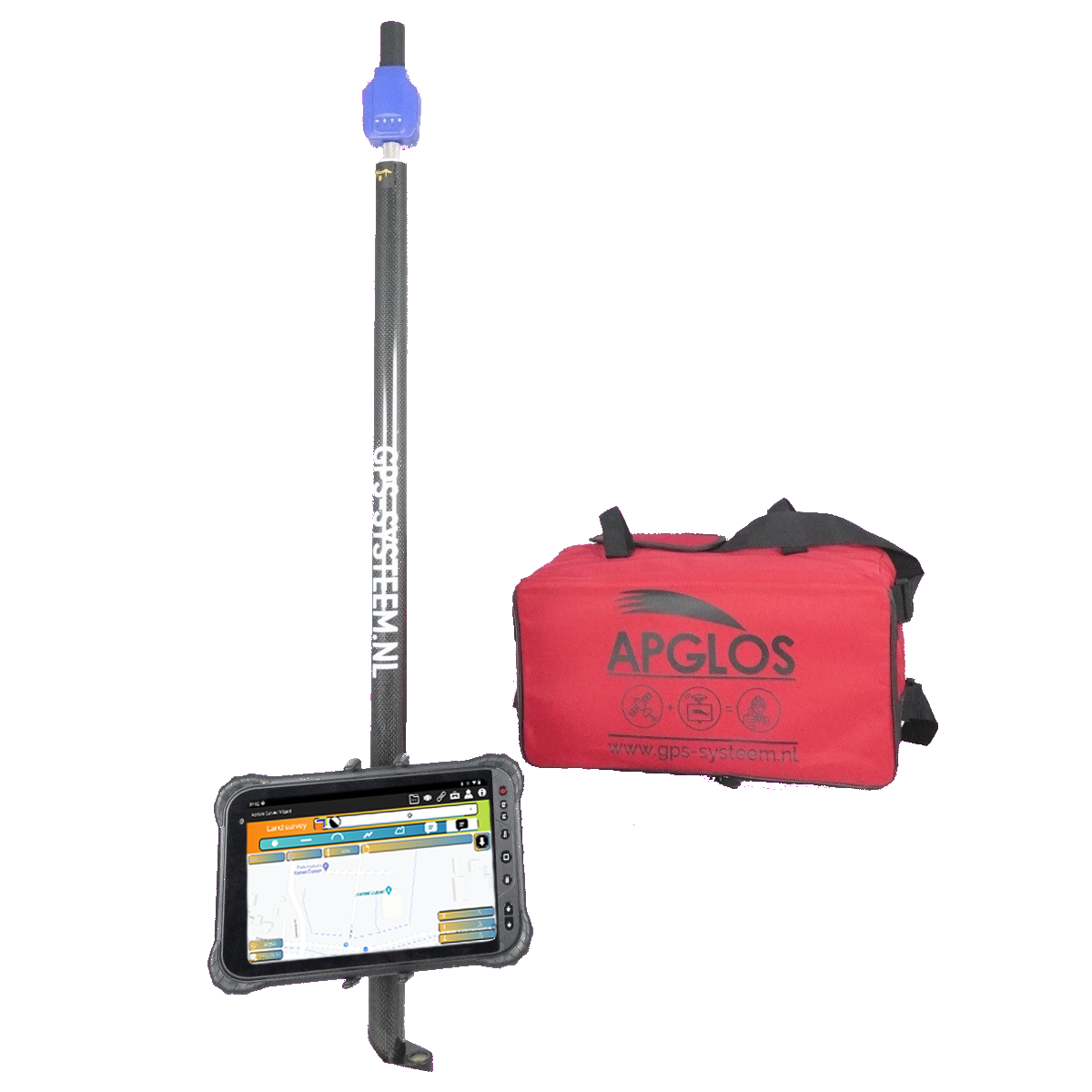
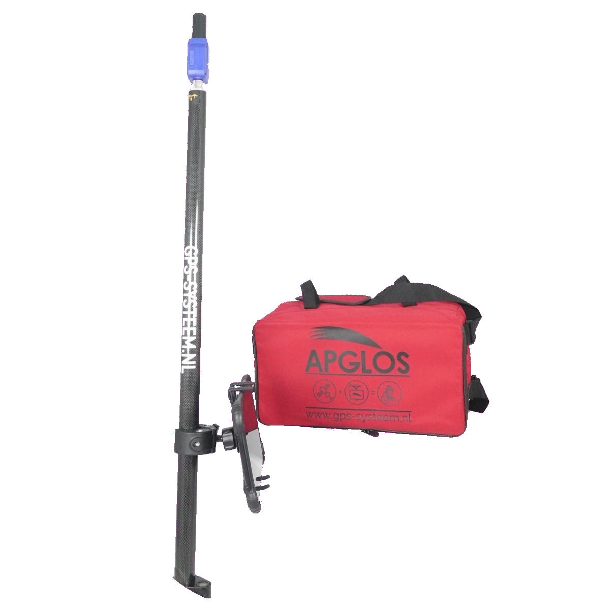
The Plus GPS Measuring System is a complete package that allows you to perform GPS measurements immediately. It consists of:
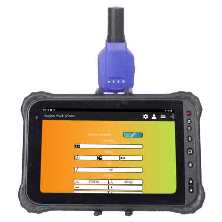
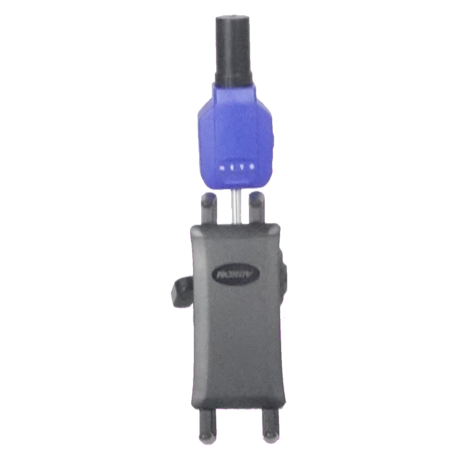
- Toknav P8: Provides accurate GPS tracking and positioning even in demanding environments, giving you reliable location data for your measurements.
- T8-20 (rugged Android tablet): Delivers advanced performance and an intuitive user experience, allowing you to work efficiently with various data processing and measurement applications and tools.
- Apglos Survey Wizard subscription package: Provides access to regular updates, new features and enhancements, keeping you always up-to-date with the latest developments in surveying technology and maintaining optimal performance.
- Tablet Holder: Provides secure and stable attachment of your tablet, allowing you to take hands-free measurements without worrying about holding your device.
- GPS lead rod 2.0 m, carbon, screw-on: With its lightweight and durable design, the GPS lead rod offers easy installation and adjustment for different measurement needs, allowing you to take accurate elevation measurements with precision and ease.
- Bag large: Provides enough space to safely store all components and easily transport them to different locations, ensuring you are always ready for your next measurement challenge.