
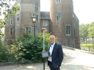
Video instructions working with a GPS system
Measuring with a GPS measurement system is easy. Yet taking the first step can be tricky. That's why we have some video instructions for
Here at GPS-system.se we want to give, all employees of contractors, engineering firms and governments or anyone else who wants to survey something, the opportunity to self survey. Self surveying has the following advantages:
The best thing you can do to achieve these benefits is to try a complete GPS measurement system.
Through this page you can try a GPS measurement system. You can then schedule the date yourself.
And because we've made it so easy for you, you can then land right away
This is because our GPS measuring equipment uses the simplest land surveying software.
This is Apglos Survey Wizard. Apglos Survey Wizard has been developed by Apglos to enable any person to
be able to have land surveying with GPS.
GPS-system.se is a partner of Apglos B.V..
Apglos B.V. is a Dutch company that develops software related to GPS.
Apglos Survey Wizard is a key application of Apglos B.V.
If you are interested in starting to survey with GPS then it is wise to try Apglos Survey Wizard.
This is also easy to try because Apglos Survey Wizard is free to download from the Google Play Store.
To download this surveying app click here.
When you sign up, you will also be notified of the offers posted regularly on the GPSystem.com website.
At GPS-System.se, we work as one team with a shared passion for accurate and efficient measurement. With more than two decades of combined practical experience in engineering, geo-information and outdoor work, we know exactly what it takes to take measurements reliably and easily.
Our solutions are designed for everyone working in the field - from professional surveyors to users who do not handle measuring equipment on a daily basis. With easy-to-understand controls and smart software, truly anyone can get started quickly, without complicated instructions or long learning curves.
We support a variety of applications: from measurements in the forestry, the mapping of cables and pipes, to register objects in public space such as light poles, sewer gullies, manhole covers and other elements essential for management and maintenance. Our goal is that you always have reliable data, regardless of the environment or complexity of the project.
At GPS System, ease of use is key, but we never lose sight of technology.
Because of our broad experience, we know what combination of simplicity, stability and accuracy professionals need to do a good job. That's why we develop systems that are not only robust, but above all practical and results-oriented.
Our vision is clear: to make modern GPS technology accessible to everyone. Whether you are an experienced professional or working with measuring equipment for the first time - we make sure you can measure quickly, independently and with confidence.
I expect our goal appeals to you and I hope to see you soon.

Measuring with a GPS measurement system is easy. Yet taking the first step can be tricky. That's why we have some video instructions for

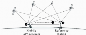
How does RTK work? RTK stands for Real Time Kinematic. It means being able to provide centimeter-accurate position of a moving object all the time.

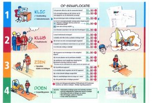
Preventing excavation damage to cables and pipes is very important in the Netherlands. After all, a lot of digging goes on in the Netherlands. And almost everywhere where there is digging there are cables